Exploring the Chief Isadore Trail with volunteer Neil Shuttleworth

Words and photos by Janice Strong
“I love working with trails,” says Neil Shuttleworth. “Trails should give people an experience, and they should leave an impression on us.”
Neil is the visionary and construction manager for the design, layout and development of the new Chief Isadore Trail near Cranbrook, in southeastern British Columbia. He is a retired Recreation Officer with the Ministry of Forests, Cranbrook branch. He has a degree in Physical Education/Outdoor Education.
“I want to feel the ecosystems we go through, and not have it stripped of vegetation for two metres on both sides,” he continues. “I want to experience the dry areas and the wet areas. The Trail should work with the landscape and not conquer it.”

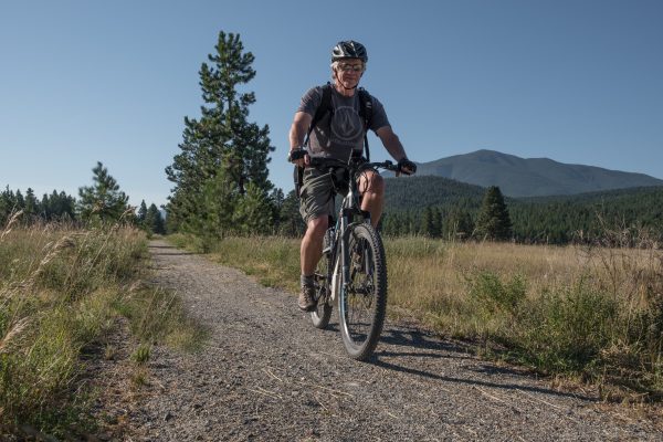
Photo: Neil Shuttleworth bikes the Chief Isadore Trail, BC.
“Working at the Ministry, the trails, their layout and site design were the gravy and by far the most fun part of my job. Now as a volunteer (with the Chief Isadore Trail), I get to pick the gravy now too,” Neil smiles.
He is glad that TCT is promoting this new section of The Chief Isadore Trail, a 43.5-kilometre section of The Great Trail from Cranbrook to the town of Wardner. It crosses many different environments, and also honours the history and customs of the local Indigenous community with a number of interpretive signs, supported by donations to TCT and with the involvement of the Ktunaxa Nation.
The Trail section also takes its name from Chief Isadore, the chief who brokered peace between the Ktunaxa Nation and settlers. Along the trail, 18 large kiosks describe local geology, history or ecosystems plus there are dozens of smaller kiosks describing a natural item situated at interesting spots along the track.

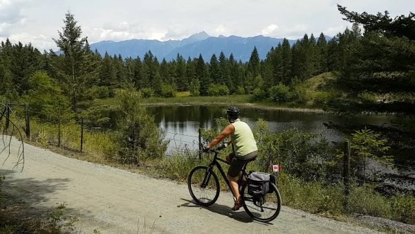
Photo: One of the many beautiful ponds along the Chief Isadore Trail.
“There are limestone kilns, and Wardner offers a bit of natural history and a historical development type of experience,” says Neil. “You get to look down the bluffs to the Kootenay River, and Bull Mountain of the B.C. Rockies rises on the northern view. The Ktunaxa involvement in the project and the story of the railroad and Wardner are explained briefly on kiosks.”
There are also a number of different sections for Trail adventurers to choose from.
“The Chief Isadore Trail is more than just a rail grade experience. It’s the enhanced single-track sections that set this trail apart from the rest. People are getting a little more adventurous and are heading a little farther out,” Neil explains as he describes the Trail section’s various parts.
“The Mayook Trail (which is a part of the Chief Isadore Trail) is one of those special segments. It’s a fun ride on a mountain bike for most people with a little bit of adventure. It climbs 200 metres of elevation and is about a metre wide.”
“My five-year-old-grandson wants to ride it, and once he gets his new five-speed gears on his bike figured out a bit better, I think we will give it a try – in the autumn,” Neil says with a proud grin.
“Riders can go 35 kilometres without seeing a house, but we are not that far away from everything. For most of the trail, we can still hear the highway.”
Riding the Mayook Trail, you have a feeling of being unsupported and on your own. It is a wild area through Douglas fir, Lodgepole and ponderosa pine forest, where you may encounter wildlife including bears, elk or even open range cattle in summer. Wildlife interactions and sightings throughout the entire southeastern part of B.C. are common.

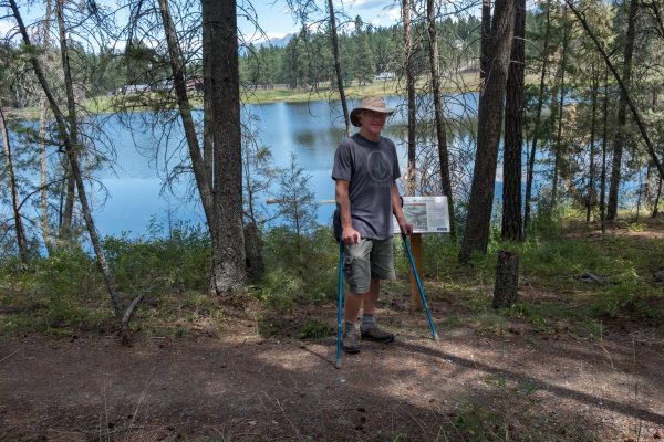
Photo: Neil hikes a section of the Chief Isadore Trail.
Neil suggests being prepared by travelling in groups, carrying a bear spray, having a bell on your bike and making noise along secluded trails.
“We are inviting city people out into the wild places, and they have to know it’s not a city park,” he says.
To get to the Mayook Trail, you can enter the Chief Isadore Trail from highway 3 east from Cranbrook, either at Pritchard Road or Ha-Ha Creek Road. There are a number of other distinctive sections of the Chief Isadore Trail.
By starting at the Isadore Canyon part from the main trailhead in the city of Cranbrook, the trail provides another experience. This part is unique as the rail grade winds along the base of a rough-walled, narrow gully of a canyon. Parts of the Isadore Canyon were hewn out of the rock by hand-tool wielding labourers working on the railway construction crews, over 100 years ago. Other parts of the canyon are likely naturally eroded. You also travel through the forest and by several small riparian areas and ponds.
The Rampart Prairie section is accessed from highway 3 from the “Rampart Rest Area”. This easy seven-kilometre loop is suitable for families or casual walkers. This enhanced single-track trail links the rest area with the Chief Isadore Trail while meandering through dry grassland, forest and by small ponds. The gently sloping grade allows cyclists to enjoy the scenery of the Rocky Mountains to the east and the Purcell Mountains to the west in a leisurely way.
Wardner is a small rural village at the east end of the Chief Isadore Trail. The town was once along the busy railway line until CPR needed to move the line in the early 1970’s when the Libby Dam reservoir was to flood the Kootenay River Valley.
For maps, check out The Great Trail map or the Chief Isadore Trail website.


![[:en]Park Canada[:] Company Logo](https://dev.tctrail.ca/wp-content/uploads/2021/05/LOGO_Partnership_Black_EN.png)


