Elevate Your Outdoor Adventures Using the Trans Canada Trail Map
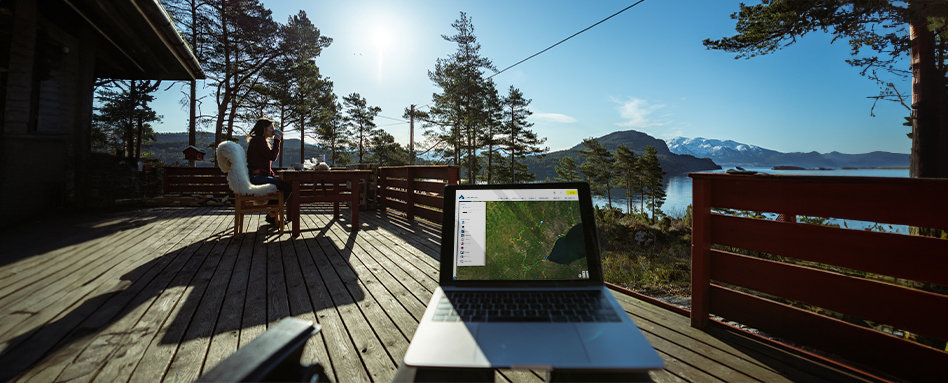
You may know that we have a map that shows the hundreds of trail sections in the Trans Canada Trail system. But did you know about all the cool things it can do? We’ve got suggestions for using our Trail map to make your summer fun even funner!
Discover new places near you
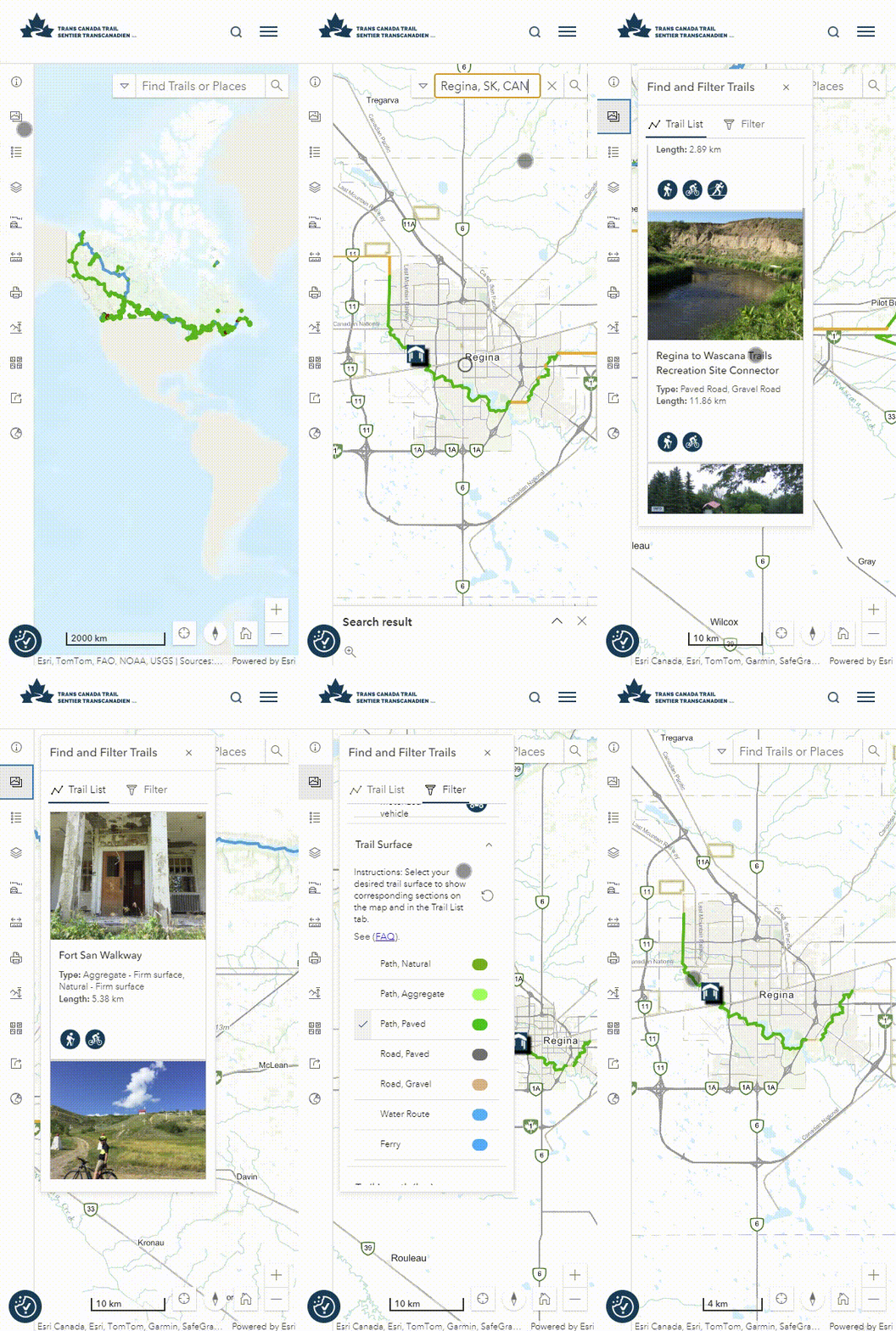
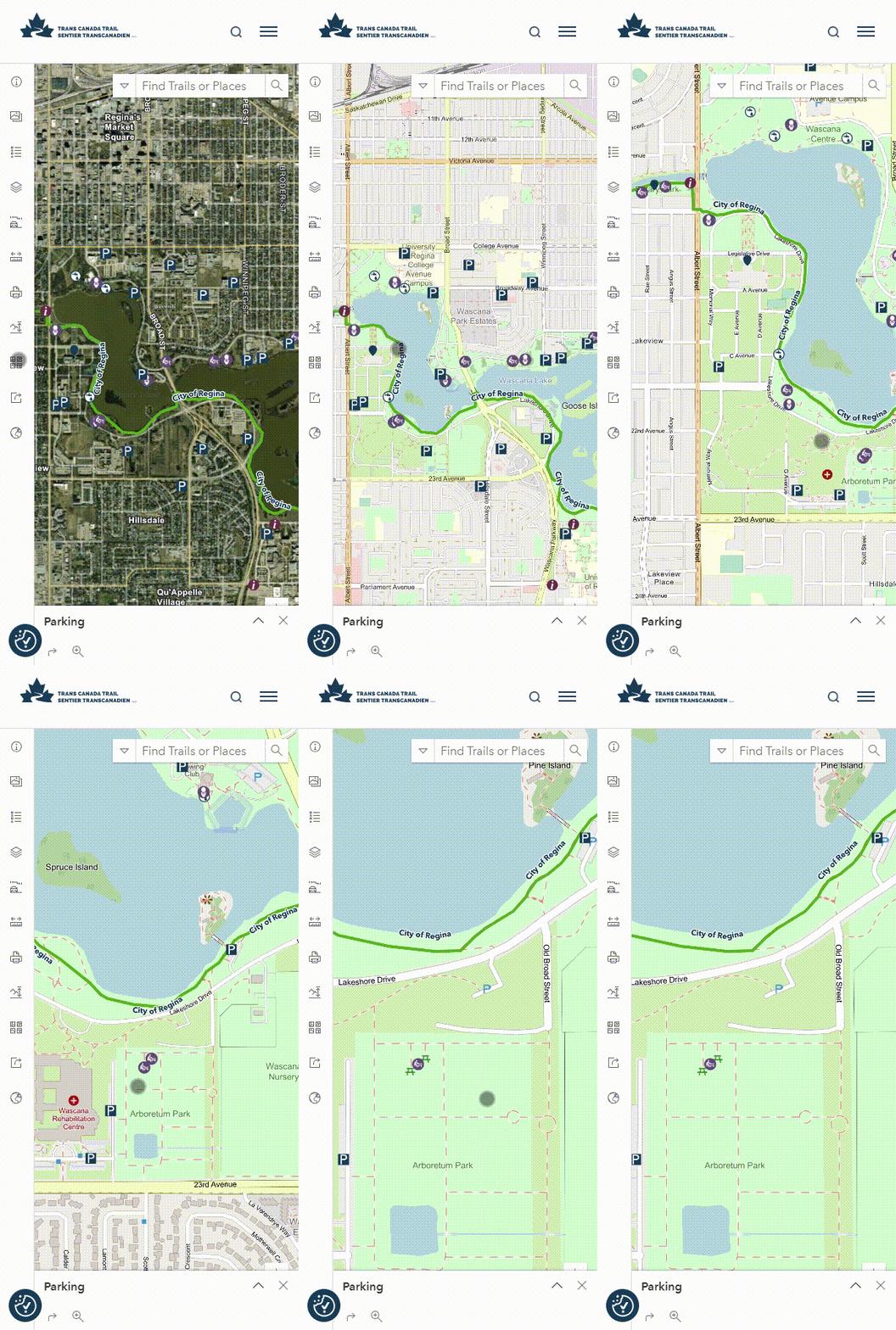
The Explore the Map page’s Find and Filter Trails function in the left menu panel allows you to view a list of the Trail sections that are included in your current view. For example, if you’re in and around the city of Regina and you zoom in on the map to show that area, you can find and filter all the trails in your vicinity. As you move around the map, the list will update to show you what’s nearby.
Pro tip: Use the activity filter to view nearby trails that permit specific activities, like cycling or horseback riding. You can also filter by trail surface.
Prepare for your Trans Canada Trail outing
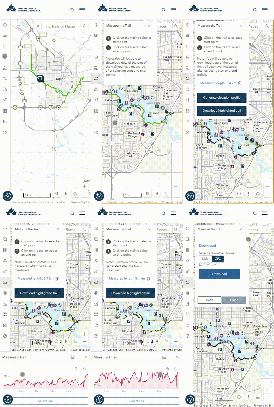
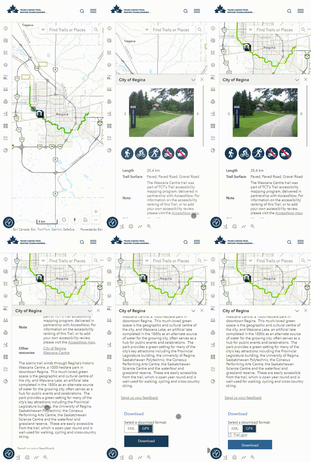
Make sure you have the info you need before you head outside! Once you select a Trail section to explore, check the description to find out about any trail closures or detours along the route. You can also check the trail’s elevation profile by clicking on the mountain icon near the trail’s description, which allows you to determine if there are any steep sections , and where they are located. You can also find out about the trail surface, permitted activities and trail gradient to see if the trail section will be accessible to you.
Pro tip: Download the files for your Trail section so that you can take them with you on your mobile, or print them out to bring along. To do so, click the Trail section on the map or in the list on the left-hand side. A Trail information window will appear on the right-hand side of the screen, and at the bottom, you’ll find a Download button.
Find the perfect lunch spot and more useful information
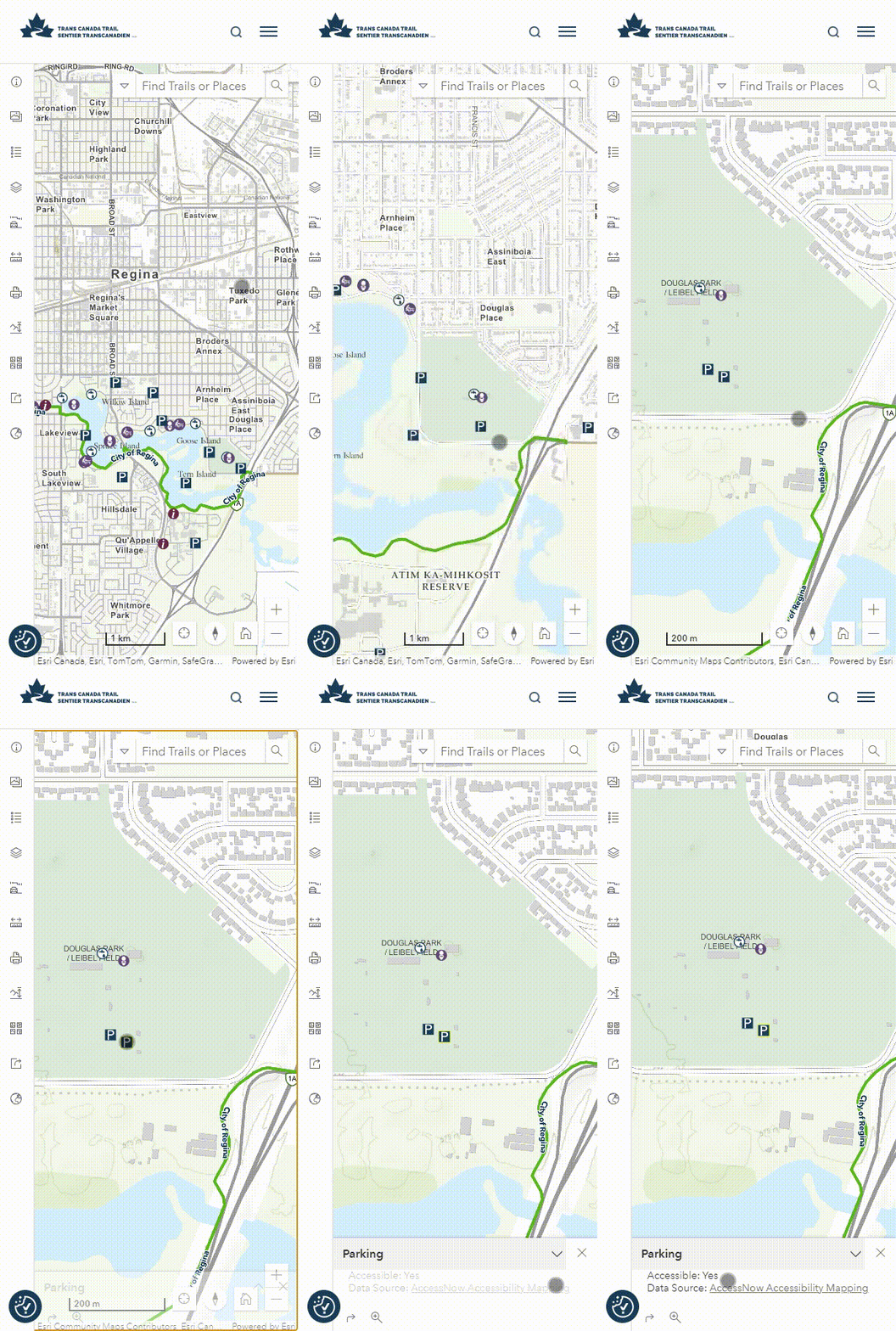
Trail: found! Route: planned! Now, take the time to scout the area. Look for the picnic table icon on the map to see great lunch or rest break options.
Pro tip: The map also provides parking and restroom information – two very useful items that will help make for a seamless trail outing.
Learn more about where you are
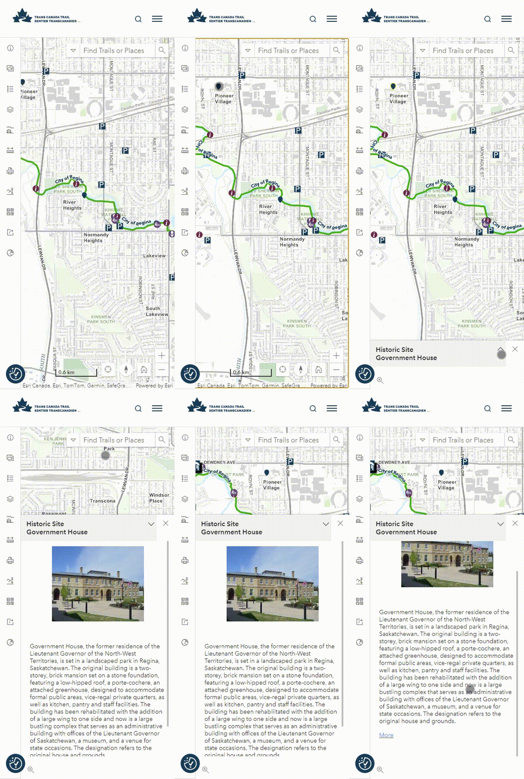
Before you go — or even while you’re out — check out the map for extra points of interest. You can find historical and cultural sites of interest like UNESCO sites, historic churches and buildings, monuments and more.
Pro tip: Visit Parks Canada’s National Historic Sites page for full information and history about historic sites along your route.
Make connections in your community
Connect to people and to the area! In the trail information panel that pops up on the map when you select a Trail section, find information about local trail groups and get in touch with any questions or feedback, or to get involved.
You can also connect to other trail networks and parks that are adjacent to the Trail through local trail groups. Visit local trail groups’ webpages – linked in the trail description where applicable – to learn more about other trails in the area and how to get involved with group activities.
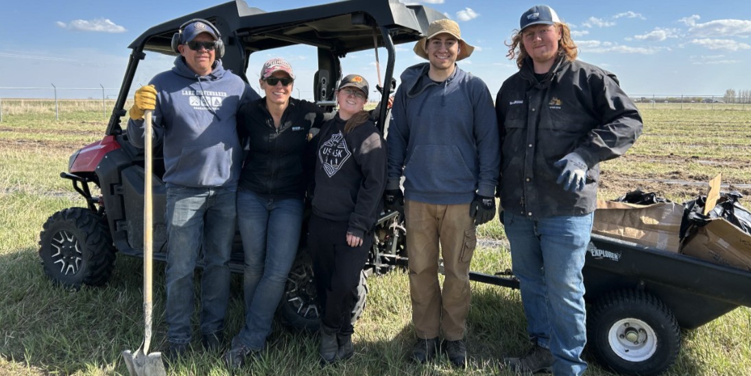
Pro tip: Looking for something fun to do? Volunteer with your local trail group! Make new friends, spend time outside, and contribute to keeping trails safe, well-maintained and accessible for your community.
Reach out with helpful information
So, say you’re on the Trail, and you encounter a trail closure or safety issue. Find the Report a Problem on the Trail link on the map and get in touch! We can then report any issues to the local trail groups or municipalities that manage that section of the Trail.
Find out more about how to use and navigate the map here. Happy adventuring! And don’t forget to share your Trail adventures by tagging us on our social media platforms! Facebook, Instagram, and Twitter.
We work with ESRI Canada on our mapping products and are so grateful for our close partnership.


