
Taryn’s Trans Canada Trail: Hiking the East Coast Trail One Spectacular Section at a Time

Written by Taryn Eyton
The van driver dropped us off in a tiny, fog-shrouded Newfoundland village, pointed us up a gravel road, and told us he’d be back in seven hours. What had we gotten ourselves into?
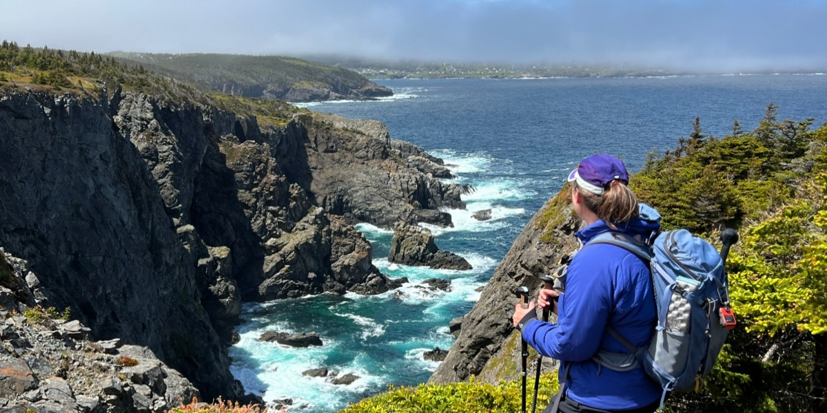
We followed the road uphill, passing cheerful yellow and red houses overlooking the harbour. Around the corner, a large sign marked the beginning of our journey on the East Coast Trail (ECT). Within minutes of putting boots to trail, we were walking along towering sea cliffs, weaving between wind-twisted spruce trees, and spotting the spouts of humpback whales offshore. It was an unforgettable introduction to one of Canada’s most spectacular trails.
Stretching more than 300 kilometres along the edge of Newfoundland’s Avalon Peninsula, the East Coast Trail follows a rugged shoreline of cliffs, coves, and picturesque fishing villages. It also passes through the heart of St. John’s, adding an urban counterpoint to the wilderness trail. It is divided into 25 individual sections, known as “paths,” each named for the local landscape or history.
The ECT is also part of the Trans Canada Trail. Trans Canada Trail’s easternmost point, called Point Zero East, is at Cape Spear National Historic Site, on the ECT, making it feel like a natural starting (or finishing) place for a cross-country adventure.
Although some hikers tackle the entire ECT in one ambitious journey, it’s much more common to explore a handful of sections over several days. Most trailheads are accessible by road, so you can hike one path each day before returning to a nearby hotel or B&B. If you’d rather camp, some of the sections have designated backcountry campsites.
A self-guided tour with Great Canadian Trails
We chose an even easier option by booking a self-guided hiking tour with Great Canadian Trails. They arranged our accommodation, including a downtown St. John’s hotel and charming B&Bs near both the northern and southern ends of the trail. Each morning, Jamie, our shuttle driver, picked us up and drove us to that day’s trailhead, returning later to collect us. During our van rides, he always had a story about the local area to share. Over our six days, we hiked six very different sections of the ECT and experienced every kind of weather possible, just as the Newfoundland locals had promised!
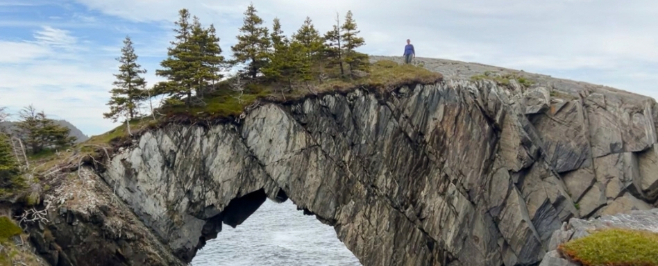
Photo credit: Taryn Eyton
Spurwink Island Path and the Island Meadow Path
Our first hike took us along the Spurwink Island Path from Port Kirwan to the famous Berry Head Arch. Years ago, photos of this dramatic arch convinced me I needed to hike the East Coast Trail. Seeing it in person was even more impressive. The official trail passes alongside the arch, but I couldn’t resist taking a narrow side trail that crosses directly over its rocky top. Standing above the waves as they surged through the opening below was exhilarating!
Next, we hiked the Island Meadow Path from Cappahayden, the southeastern terminus of the ECT. At the end of the day’s hike, we made our way to Merrymeeting Arts and Crafts in the tiny community of Renews to meet our driver for the trip back to our B&B. While we waited, the owners, John and Rita Chidley, welcomed us inside to get out of the wind and enjoy a hot cup of coffee. As we chatted, they shared stories of the many ECT hikers who passed through over the years. It was one of those small moments of Newfoundland hospitality that stuck with me long after the hike ended.
Topsail Beach and Shoe Cove
A few days later, we experienced the opposite end of the ECT while hiking the Long Shore Path from Topsail Beach, the northwestern terminus. There was something satisfying about standing at one end of such a long trail, imagining all the coastline stretching away to Cappahayden.
The Stiles Cove Path transported us back in time as we wandered into the abandoned community of Shoe Cove. Looking down into the narrow cove, with waves crashing into the cliffs, I found myself wondering how generations of fishers had managed to launch their tiny wooden boats in such unforgiving conditions.
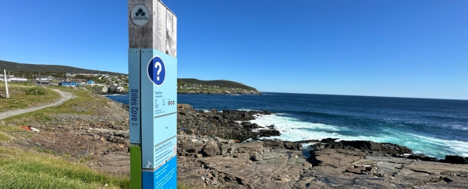
Photo credit: Taryn Eyton
Cape St. Francis Lighthouse and Quidi Vidi Village
On the Biscan Cove Path, the trail wound through stands of twisted spruce before emerging onto broad, rocky headlands. We hiked all the way to Cape St. Francis Lighthouse, the northernmost point of the East Coast Trail, and looked across Conception Bay to the Bay de Verde Peninsula while a salty wind whipped across our faces.
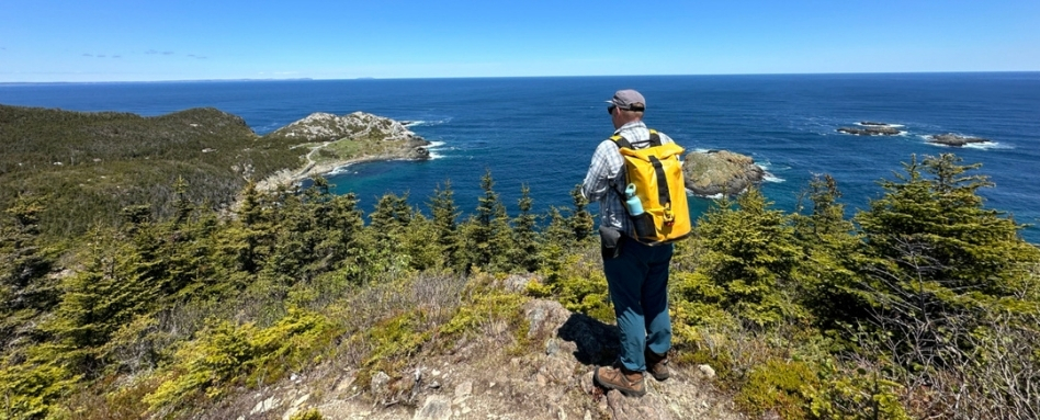
Photo credit: Taryn Eyton
Our final day saw us hiking the Sugarloaf Path. We walked high above the roiling Atlantic before descending into colourful Quidi Vidi Village. After several days immersed in dramatic coastal wilderness and tiny villages, it felt fitting to follow the trail towards the bustling streets and brightly painted jellybean houses of St John’s.
Some trails are defined by a single iconic viewpoint. At the start of my trip, I thought that viewpoint would be Berry Head Arch. But after spending six days walking its paths, I discovered that the magic of the ECT is in its variety. I found new treasures around every windswept corner: gnarled forests, grassy headlands, pebbled coves, dramatic sea cliffs, spongy bogs, colourful fishing villages, and friendly locals eager for a chat. We only sampled a few of the East Coast Trail’s 25 paths, but it was enough to convince me that someday I’ll return to hike the rest.
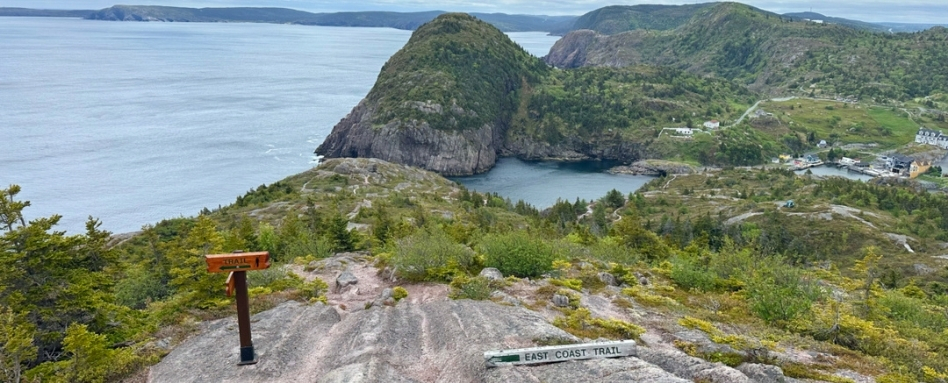
Photo credit: Taryn Eyton
Taryn Eyton is a Squamish-based writer and the founder of the outdoor adventure website, HappiestOutdoors.ca. She is also the author of two hiking guidebooks: Backpacking in Southwestern British Columbia: The Essential Guide to Overnight Hiking Trails (Greystone Books, 2021) and Backpacking on Vancouver Island: The Essential Guide to the Best Multi-Day Trips and Day Hikes (Greystone Books, 2024). Taryn is a Leave No Trace Master Educator, the President of the Friends of Garibaldi Park Society, a member of the Board of Directors of the Vancouver International Mountain Film Festival, and a Fellow of the Canadian Geographic Society.
Follow her on Instagram at @happiestoutdoors or Facebook at https://www.facebook.com/happiestoutdoors.
Explore Newfoundland trails and hiking trails across Canada on our interactive map.
During the month of September, get outside and get moving during the Great Canadian Hike. From September 1 to 30, hike, bike, paddle or roll in support of Trans Canada Trail.
Feature photo credit: Taryn Eyton