
Robin and Arlene’s Trans Canada Trail: Exploring Saskatchewan’s Cypress Hills

Written by Robin and Arlene Karpan
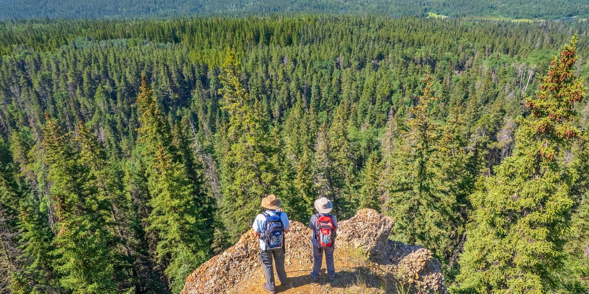
Standing on the edge of the cliff, we gaze over a vast valley of thick forest. But just behind us on the plateau, expanses of open prairie meadows are alive with multi-hued wildflowers. Here, more than anywhere along the Trans Canada Trail, we get a sense of the unique nature of the Cypress Hills, a stunning medley of grasslands, forest, and highlands.
The Cypress Hills are tucked into the Canadian Prairies’ deep south, straddling the Saskatchewan/Alberta border. This is one of few places on the Prairies not glaciated during the last ice age, leaving the highest elevation in Canada between the Rockies and Labrador. While surrounded by mostly open prairie, the hills encompass large patches of lodgepole pine, spruce and aspen forest. This mingling of habitats provides a rich biodiversity, a haven for wildlife and among the most dazzling wildflower displays we’ve seen anywhere.
Cypress Hills Interprovincial Park
Cypress Hills Interprovincial Park protects much of the area. The Saskatchewan side, where we like to wander, has two sections — the Centre Block, home to most visitor services, and the wilder West Block for the ultimate in backcountry exploring. The Trans Canada Trail runs through both blocks, providing access to the best of this amazing landscape.
The most popular portion of the trail is in the core area of the Centre Block, a stone’s throw from campgrounds, accommodation and other visitor services. Here it links to the park’s extensive network of shorter trails. One stretch is even paved, making it easily accessible to anyone.
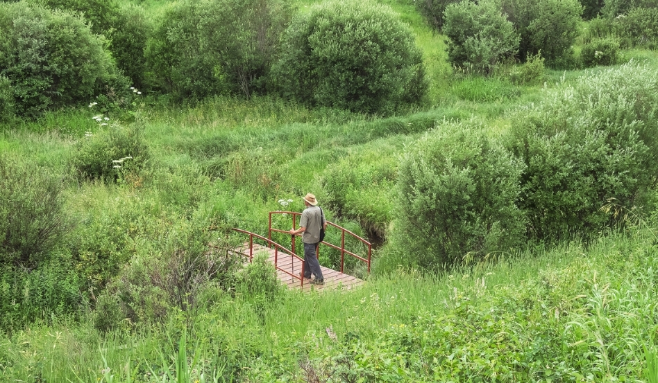
Photo credit: Robin and Arlene Karpan
Centre Block Trails
From the small recreational lake of Loch Leven, the Trans Canada Trail heads both east and west. We especially like the eastern arm, running through thick forest at first, then alternating with wetlands, hills, and meadows, ending after 13.8 kilometres at a trailhead on the park access road. A highlight along the way is a delightful hilltop lookout with a bench in the midst of wildflowers.
Wildflowers alone merit a visit to the Cypress Hills. Mountain shooting stars, pinkish purple sticky geraniums, wild bergamot, and lupins are some of the many species. When it comes to orchids, this is clearly the top place on the Prairies, with 18 species recorded, including the showy calypso orchid and rarities such as the round-leaved orchid and mountain lady slipper.
The western section of the trail is much the same length, starting at Loch Leven, passing through the core area, then heading southwest through a series of meadows and woodlands. It ends at a trailhead on the southwest corner of the road that circles the Centre Block.
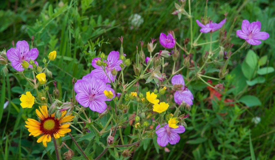
Photo credit: Robin and Arlene Karpan
West Block
We enter the park’s West Block in dramatic style as the access road winds up the escarpment on a series of switchbacks. After a few kilometres on the plateau, we descend into the Battle Creek Valley where the only through road in the West Block provides access to the Trans Canada Trail.
The West Block is our favourite part of the Cypress Hills. Not only does it offer the most breathtaking scenery, but it also attracts only a fraction of the visitors who head to the Centre Block or the Alberta side of the park. It’s more of a wilderness experience, with no facilities other than a Ranger Station and basic campgrounds. The roads can be an issue in wet weather. Crowds, however, are never an issue, even in midsummer.
While the Trans Canada Trail spans 17.5 kilometres across the West Block, the central portion crosses Battle Creek Road and runs along it for a short stretch, offering easy access. The eastern section climbs up the valley slopes along South Benson Road, which is more of a deeply rutted minor dirt trail, offering sweeping vistas. It then heads east along a mix of hilly meadows and woodlands, ending near the park’s border with Fort Walsh National Historic Site, also worth a visit for its storied Mounted Police history.
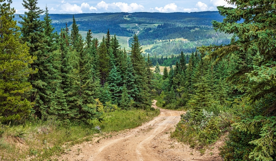
Photo credit: Robin and Arlene Karpan
Hidden Conglomerate Cliffs
The western section takes us to what we consider the highlight of the entire route: the Hidden Conglomerate Cliffs. Jutting out from the valley rim, the reddish-tinged conglomerate formations were formed from smooth water-worn cobblestones naturally cemented together over the centuries. They are called hidden because we can’t see them from Battle Creek Road, since trees block the view. The trail offers the only access. Some maps refer to this section as the High Vista Trail, the name used by the park before it was incorporated into the Trans Canada Trail.
It’s a bit of a workout, with an altitude gain of around 200 metres and some steep sections. But once we see the eye-popping view from the valley rim, the effort makes it all worthwhile. From the welcoming bench on top, we look over the cliffs and the broad, heavily wooded valley beyond. Other than the bench and a couple of trail markers, few visible signs of “civilization” intrude on the natural wilderness setting. We’ve often come to this spot over the years. We never tire of it, and we always have it completely to ourselves.
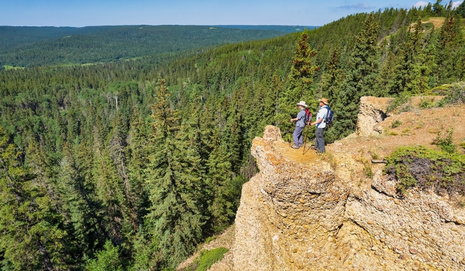
Photo credit: Robin and Arlene Karpan
Final thoughts
For us, the Trans Canada Trail is the key to truly appreciating the Cypress Hills. It’s a chance to get away from the roads and experience the natural beauty of this remarkable landscape. The best part is that there is something for everyone, from short strolls or bike rides close to park amenities to more remote backcountry excursions to experience wonders of nature accessible no other way.
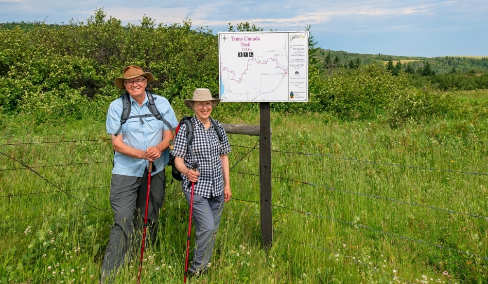
Photo credit: Robin and Arlene Karpan
Robin and Arlene Karpan (@karpanphotojourneys) are award-winning writers, photographers, book authors and bloggers based in Saskatoon. They publish the popular blog photojourneys.ca, recognized by Feedspot as among the Top 100 Travel Photography Blogs worldwide. They are authors of several travel and photography books, such as Saskatchewan’s Best Scenic Drives and The Great Saskatchewan Bucket List, which have become Canadian Bestsellers. Robin and Arlene have a special interest in discovering and photographing the natural world.
About the Trans Canada Trail
The Trans Canada Trail offers a wide range of activities through a variety of landscapes – urban, rural and wilderness; along greenways, waterways and roadways. It reaches every province and territory, and connects all three of Canada’s coastlines. By supporting Trans Canada Trail, you’ll help to ensure that the Trail will be around for generations to come – as a place to connect to nature and to one another. Learn more about ways to support the Trail.
Find more Saskatchewan hiking trails on our interactive map or from one of our provincial trail partners, Saskatchewan Trails Association.
Feature photo credit: Robin and Arlene Karpan