Taryn’s Trans Canada Trail: Everyday Outdoor Adventures in Squamish
Written by Taryn Eyton
My hometown of Squamish, BC, is wedged between the ocean and the mountains partway between Whistler and Vancouver, so it’s a pretty outdoorsy place to live. The Trans Canada Trail runs right through nearly every neighbourhood — as part of the Sea to Sky Trail — and locals like me use it on their everyday outdoor walks, runs, hikes and bike rides.
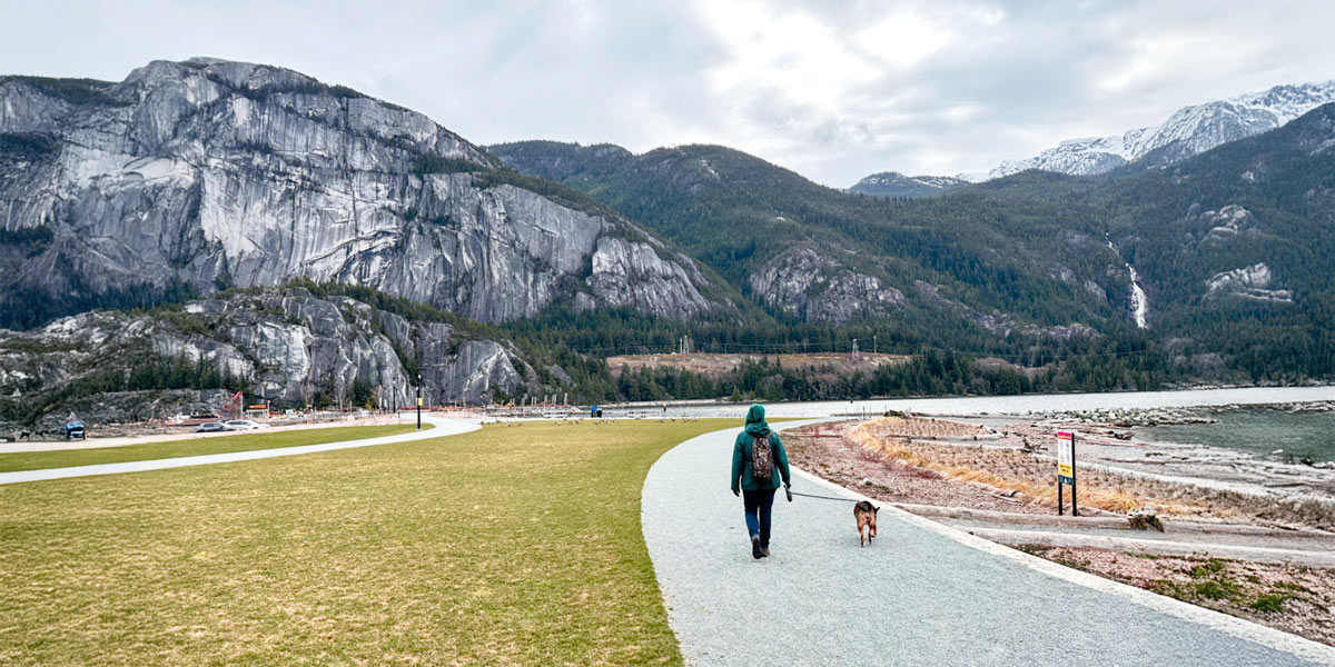
Waterfront walks at Sp’akw’us Feather Park
If I want to take out-of-town visitors for a scenic walk, I bring them to Sp’akw’us Feather Park. This oceanfront park opened in 2024 and has incredible views of Howe Sound, Shannon Falls and the Stawamus Chief, which is one of the largest granite monoliths in the world. The area was formerly an industrial site but has been rehabilitated. It now includes a playground, a native plant garden and several pieces of public art including “Welcome Gate” by Squamish Nation artist James Harry.
You can drive to the park, but I prefer to pick up a coffee at one of the cafes on Cleveland Avenue in downtown Squamish, then walk to the park along the Waterfront Trail, part of the Trans Canada Trail. It’s 1.5 kilometres each way, to and from downtown, along a path that follows a small inlet of the Squamish Estuary.
Errands and exercise on the Corridor Trail
The paved, multi-use Corridor Trail runs for 8 kilometres through the heart of Squamish and forms part of the Trans Canada Trail. It’s a great way to get between Squamish’s neighbourhoods on foot or by bike without worrying about cars – it is fully separated from the road.
I often use the Corridor Trail to bike to downtown Squamish to go grocery shopping or visit the Farmer’s Market. The trail also passes popular spots like Garibaldi Village Shopping Centre, Brennan Park Recreation Centre, Smoke Bluffs Park and the Squamish Adventure Centre. Locals also love to run on the Corridor Trail because it’s flat, easy and lit at night.
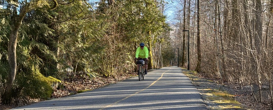
Photo credit: Taryn Eyton
Mountain biking on the Ray Peters Trail
Squamish has a huge network of mountain bike trails. While some of them can be intimidating to a beginner/intermediate rider like me, that’s not the case with the Ray Peters Trail in the Brackendale neighbourhood. It’s an easy green-rated 4.8-kilometre loop trail that circles a community forest. The western side of the loop is part of the Trans Canada Trail.
While the Ray Peters Trail itself is fun to ride, I recommend exploring the slightly more challenging trails that branch off from it. They are still rated green, but you’ll have to navigate some small drops and technical sections. My favourites are Larry’s Loop, Rusty Bucket and Sweet Judy. A word of caution: the trails are not well marked, and it is very easy to end up off-track. However, all the routes eventually lead back to the Ray Peters Trail, so you won’t get too lost. The Trailforks app is handy for route finding.

Photo credit: Taryn Eyton
Road biking in Paradise Valley
In the northern part of Squamish, the Trans Canada Trail includes a 10-kilometre on-road section along Paradise Valley Road before it goes off-road again. This quiet road runs through the Cheakamus River Valley past some rural properties and through some gorgeous groves of bigleaf maple trees. Some sections have great views of snow-capped Cloudburst Mountain.
Paradise Valley Road is my favourite place to go road biking in Squamish. It has the two things I want in a road ride: almost no traffic and beautiful scenery. The last few kilometres are gravel that gets progressively loose and bumpy, so if you’re on skinny tires, you might need to turn around before the end. If you want to add a few extra kilometres, detour down Midnight Way to visit the Tenderfoot Creek Hatchery. You can take a self-guided tour of the facility, which raises coho and chinook salmon. In the fall, don’t miss the salmon spawn, which attracts lots of bald eagles.
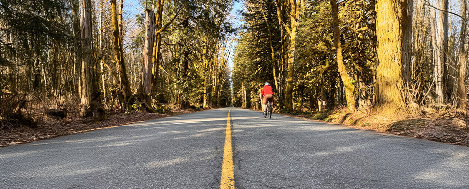
Photo credit: Taryn Eyton
Hiking to Starvation Lake and Cheakamus Canyon
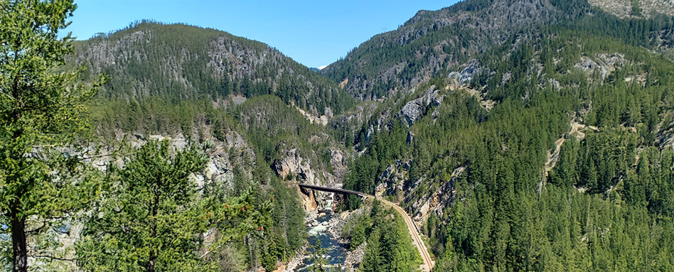
Photo credit: Taryn Eyton
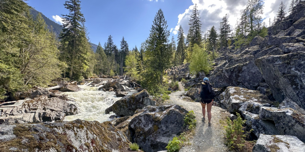
The hike to Starvation Lake and Cheakamus Canyon is one of my Squamish favourites – and the route follows the Trans Canada Trail. It starts at the end of Paradise Valley Road and runs for 4.5 kilometres before intersecting with Highway 99. You could hike it as a one-way trip using two cars, but I always do it as an out-and-back since it only takes about three hours.
The first part of the route climbs uphill from the Cheakamus River through the forest. About 2.5 kilometres from the start, you’ll arrive at Starvation Lake. This is one of my favourite spots in Squamish to swim. The lake is small, so it’s fairly warm, even early in the season. Past the lake, the trail follows the side of the steep Cheakamus River Canyon. There are a few viewpoints where you can look down and see the turquoise river waters and a skinny railway trestle bridge far below you.
Taryn Eyton is a Squamish-based writer and the founder of the outdoor adventure website, HappiestOutdoors.ca. She is also the author of two hiking guidebooks: Backpacking in Southwestern British Columbia: The Essential Guide to Overnight Hiking Trails (Greystone Books, 2021) and Backpacking on Vancouver Island: The Essential Guide to the Best Multi-Day Trips and Day Hikes (Greystone Books, 2024). Taryn is a Leave No Trace Master Educator, the President of the Friends of Garibaldi Park Society, a member of the Board of Directors of the Vancouver International Mountain Film Festival, and a Fellow of the Canadian Geographic Society.
Follow her on Instagram at @happiestoutdoors or Facebook at https://www.facebook.com/happiestoutdoors.
Explore the Sea to Sky Trail on our interactive map!
Primary photo credit: Taryn Eyton


