Claude’s Trans Canada Trail: A Cycling Loop in the Eastern Townships

Written by Claude Plante
The meeting point was in the car park of a church overlooking what is known as the village of Rock Forest in Sherbrooke, Quebec. The challenge: to cycle one of the few loops formed by the Trans Canada Trail in the province, Les Grandes-Fourches. The route is nearly 60 kilometres long.
The main challenge of this loop lies in the steep hills that our small group of cyclists will have to tackle, but these hills will be offset by landscapes that are each more exceptional than the last.
As we cycle along, we will pass through typical Eastern Townships hamlets, immerse ourselves in scenery worthy of New England, and stop at out-of-the-ordinary tourist attractions.

The Grandes-Fourches loop in the Eastern Townships spans over 60 kilometres. Photo credit: Claude Plante
Get your legs moving!
Time to get going! We hop on our bikes and set off to discover the best that the Eastern Townships have to offer.
The first few kilometres take us to the Base de plein air André-Nadeau. The bike path crosses this outdoor recreation centre, where Sherbrooke residents enjoy a variety of sports (sledding, cross-country skiing, soccer and running, to name a few).
Next, we detour off the bike path for the pièce de résistance: chemin Beaudette. You’ll need to work hard for a few kilometres to tackle the hills that await you here. The road rears up and reminds us that in the Eastern Townships, nothing comes for free.
But the effort is worth it; the landscapes that unfold before you demand that you stop — yes, to catch your breath, but also to contemplate the mountains in the distance.
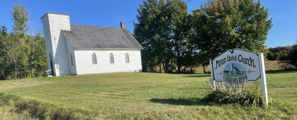
After having ascended chemin Beaudette, we arrive at a crossroads forming the hamlet called Minton. Here, a small white church bears witness to the region’s Loyalist past. Photo credit: Claude Plante
A journey steeped in history
This quiet gravel road leads us to a crossroads forming the hamlet of Minton. A small white church, a testament to the region’s Loyalist past, stands before our group of cyclists in the heart of the municipality of Hatley Township. Before the arrival of Europeans, this region was populated by the Iroquois and Abenaki (W8banaki) peoples, who hunted and fished near the St. François River.
Continuing along Route Verte No. 1, we arrive in North Hatley, one of the most beautiful villages in Quebec. It stands out for its boutiques, bistros and cafés, as well as its historic churches. North Hatley is also notable for its park on the shores of charming Lake Massawippi. Tourists may also want to take advantage of the high-end accommodations available in the village.
Next, it’s off to Sherbrooke, the regional capital, via the Axe de la Massawippi. This section of Les Grandes-Fourches, which is flatter and on dirt roads, takes us through a landscape with abundant vegetation.
After a few kilometres, we reach a must-stop: the Capelton Mine, a renowned historical and tourist site in the Eastern Townships. It’s been open to visitors since 1995, offering a visit to the underground galleries of the former mining complex. In the 1860s, due to the American Civil War, its copper was in high demand.
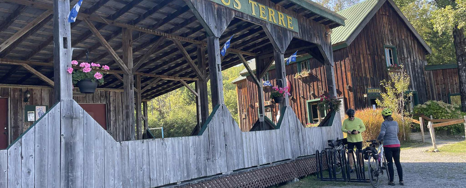
The Capelton Mine historic site offers visitors the chance to explore underground galleries of the former mining complex. During the American Civil War, its copper was in high demand. Photo credit: Claude Plante
A touch of New England
The next stop takes cyclists into a whole new world, reminiscent of New England. Bishop’s University’s campus, with its historic red brick buildings, is truly impressive.
Founded in 1843, this small English-language university in the Lennoxville area of Sherbrooke was originally a higher education institution and training centre for Anglican clergy. Today, students come from all over Canada to take advantage of its teacher-to-student ratio, which is among the most favourable in the country.
Sports such as football, basketball and rugby are played under the distinctive purple banner of the Gaiters.
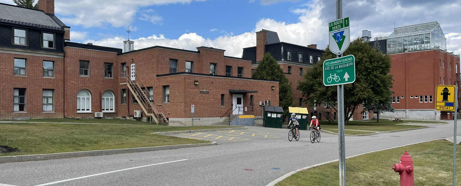
Bishop’s University campus is known for its historic buildings and red bricks. Photo credit: Claude Plante
Les Grandes-Fourches
The Saint-François Corridor then takes us to the heart of the city of Sherbrooke. The sixth-largest municipality in Quebec has a population of approximately 180,000. Its city centre attracts people with its restaurants, shops and nightlife.
Sherbrooke was founded at the confluence of the Magog and Saint-François rivers, facilitating the transport of goods.
Before flowing into the Saint-François, the Magog River forms a lake, Lac des Nations, whose banks have been developed to create a pedestrian and cycling trail that is very popular with residents and visitors. Lac des Nations is the site of several major artistic and community events, including the Marché de la Gare, which attracts Sherbrooke residents looking to buy fresh fruit and vegetables.
The Magog route takes us to our starting point along the river. We still have to put in some effort, as this section is challenging, with some steep hills to tackle, reminding us of the first few kilometres of this journey through the heart of the Eastern Townships.
Completing this circuit means accepting that you will work up a sweat, but above all, discovering the authentic, welcoming – and hilly – Eastern Townships.
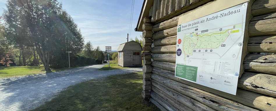
The bike trail crosses the Base de plein air André-Nadeau, an outdoor recreation centre where Sherbrooke residents and visitors can enjoy several sports, including cross-country skiing, soccer and track and field. Photo credit: Claude Plante
For the past 30 years, Claude Plante has been exploring cycling trails in Quebec and elsewhere in Canada. His adventures led him to become a columnist under the name le Cycliste du Dimanche (the Sunday Cyclist), sharing his discoveries on social media. A career journalist, he worked at La Tribune de Sherbrooke for 30 years and now works with the team at 107.7 Estrie (Cogeco Media), while also carrying out writing assignments for various organisations.
Follow him on Facebook: @lecyclistedudimanche
Did you know that the name of the Trail section Les Grandes-Fourches comes from the Abenaki name for the place where the Magog and Saint-François Rivers meet? To discover even more about the region, check out our interactive map!
Main photo credit: Claude Plante


