There are different styles, categories and sizes of signs needed for the many situations that are encountered on the Trans Canada Trail. They can be categorized by the trail type they are intended for, and further into a sign function type. Examples include the following:
Blazes and cairns
Offset blazes were first adopted in the early 1970s and are common throughout North America. They perform a role similar to wayfinders and arrows.
Blazes are recommended in situations where the installation of an aluminum sign is not possible, such as outback, rural, or rugged trail. If using this system throughout your trail, it is important to communicate this method to your users. Providing a symbol reference on a main trailhead or website will assist your travellers in navigating successfully using this system. 
Cairns are carefully arranged piles of stone, usually installed at higher elevations where trees are unavailable for blaze markings. They are also commonly seen in the Arctic region of North America. They too provide wayfinding along the Trail. Though interesting, cairns are not a reliable method for user navigation. Cairns are often altered due to vandalism, wildlife interference and weather, which can throw a traveller off course quickly.

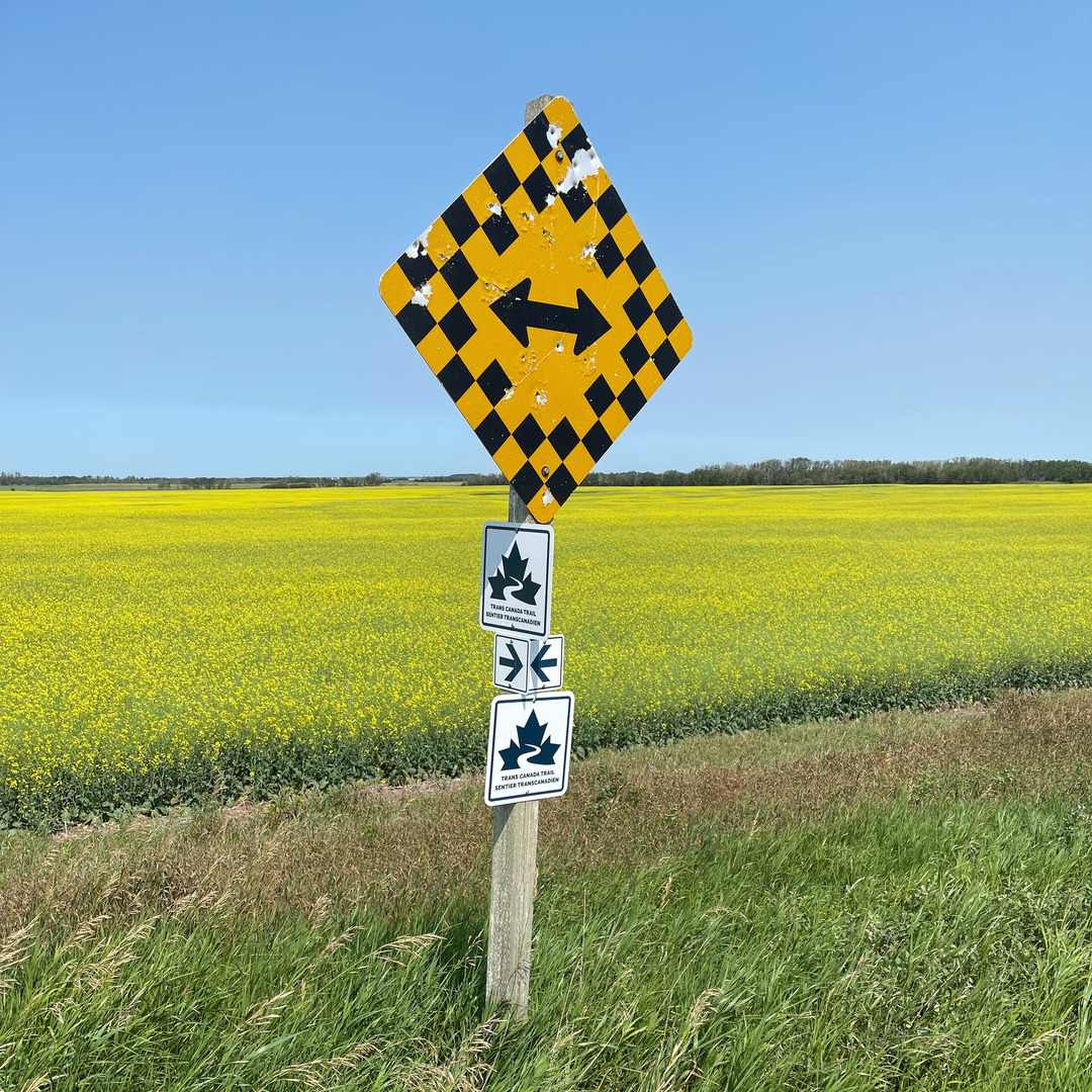
Directional
Directional signs (typically arrows) give trail users information at decision-making points as to what direction the trail follows. These signs should be used in conjunction with Trans Canada Trail wayfinders.
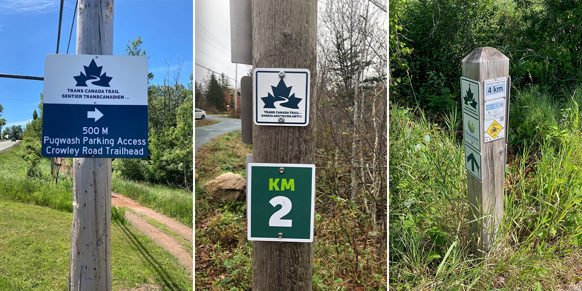
Kilometre markers
Kilometre markers are used to inform trail users what distance they have travelled. These can simply be wayfinders, arrows or any reassurance signage. Some trails use square posts mentioning the kilometre measurement. These can also be painted onto paved trail where pavement marking can easily be done. GPS coordinates are also useful for many trail users.
Regulatory signs
Regulatory and warning signs should be placed throughout the trail in appropriate locations (i.e., crossings, areas with limited visibility, cliffs, etc.) and comply with local standards. Since excessive signage may cause trail users to feel restricted or overwhelmed with information, warning signs should be placed only where necessary. Locations for the signs should be identified in engineering studies and during the trail design phase.
Regulatory signs such as “Stop,” “Yield,” and “Do Not Enter” signs should conform to the standard (ISO) shape and colours used on roads, but they can and should be smaller than signs intended for roads. For reference, see: Ministry of Transportation Ontario’s guidelines.
On roadway, reflective signage may be required. Be sure to inquire about the type of reflective material needed in the signs’ specific area. These will differ based on grade of traffic. It is also important to confirm installation requirements on each section of roadway, which will differ based on grade, surface and speed of vehicular traffic. Signage on roadway is not necessarily for the trail user, but to inform vehicle traffic that they are sharing the road with slow-moving trail users.
Where land trail intersects with roadway, signage is important. As a traveller moves across a land trail, they are not always aware of an oncoming intersection with a busy roadway. It is vital to sign this appropriately. Many trails will use a simple stop sign, where others provide larger sign clusters indicating the road name, and all other necessary information like trail access points. Adding reflective tape is an added safety feature. These structures can also be used to mitigate traffic and block vehicles from entering the trail. Usually, a 4-in. x 4-in. metal post standing 6–8 ft. tall has over 10 sq. ft. of sign panel space to inform the trail user of all necessary information.
Regarding waterways or signage near waterways, significant markers are required that comply to provincial standards and may require special permits. Consult with jurisdictional authorities to ensure your water trail is properly signed. A trailhead near the portage advising of water safety is highly recommended. On this sign, it will be important to inform the user if emergency services are available and if there are any water hazards. For an overview of such signs, contact jurisdictional authority office for their current standard signage requirements and/or catalogue.
Warning signs should be either yellow or fluorescent yellow-green and diamond-shaped. Temporary construction warning signs may be orange. Sign companies will be familiar with applicable standards; however, final responsibility for accuracy rests with you.
It is vital that warning signs are posted to reduce risk and to minimize liability issues. It is recommended that a risk management audit be conducted, and any resulting signage suggestions be implemented.
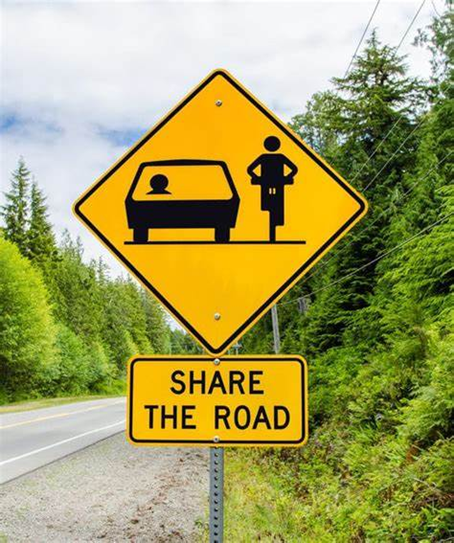
Share the road sign.
Wayfinding signs
Aluminum wayfinding signs are used along the Trail to reassure users that they are still on a section of the Trans Canada Trail. They may also be paired with other signs to associate the pairing with the Trans Canada Trail network.

Trailhead and kiosk signs
Trailheads are used at major waypoints. These large-scale signs usually have a map, trail use icons, GPS location and any other pertinent information to ensure safe travel. Mapping should include a “You are Here” point, a compass rose, and it is suggested to give a 5 km reference and a 5+ km mapping reference if applicable. Additional regional mapping can be included if necessary.
Trans Canada Trail suggests that each trailhead sign include the following information:
- The text “Use trail at your own risk”
- The text “Recreational Trail”
- Icons showing the activities that are permitted and not permitted on the trail (for example, walking, dogs on leash, etc.)
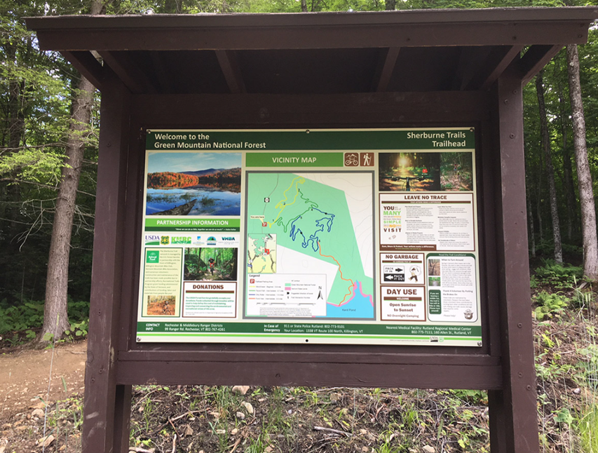
Trailhead kiosk with map of trail, rules and regulations, and other trail information.
Trailheads also include Indigenous Land Acknowledgements, when possible. Should you need assistance in researching this information, contact the local Indigenous community to confirm the correct wording for your area. Trans Canada Trail staff can also provide further direction on how to find this information.
For trail approaching the US border, it is recommended that a warning be included. This can be indicated on the trailhead map or within the content. To bring attention to this essential information, it is suggested it be highlighted in a visible way. If necessary, additional signage along the trail is recommended.
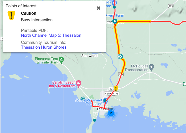
Map highlighting the condition of the trail.
The term “kiosk” is often used when a trailhead has a roof detail. This overhang peaked roof provides shelter during inclement weather and should be considered in areas of the country that experience heavy rainfall. The roof also provides added protection to the sign graphic, often giving shade and reducing UV exposure.

Unique markers
There are some instances where Trail users benefit from additional information beyond the immediate information provided by standard trail markers. In these cases, unique markers should be considered.
Unique markers are custom signs that carry the Trans Canada Trail brand and provide context to the user’s current location within a section of trail. The following are instances where unique markers should be considered:
- Unsigned Segments: occasionally you may encounter a segment of trail that cannot or does not allow for signage to be posted. A unique marker can be used prior to this situation to give the trail user vital navigational information.
- Complex Segments: unique markers can improve the experience of navigating winding, criss-crossing, or otherwise disorienting trails. A contextual view of the current section of trail can prepare a trail user so they can confidently navigate the confusing situation ahead.
- Local Trail Loops: unique markers can be used to help a user navigate a local loop, as well as provide a better experience when deviating from the main trail. In addition to navigation, the marker may provide information on local amenities or attractions.
When deciding on content for unique markers, priority must be given first to navigational aids, and then to any information that improves the trail experience. Below are some common components of unique markers that may be useful when choosing content:
- Contextual Map: a map can provide much more contextual information than text. When generating a map, ensure that the scope of the map is relevant to the context of the segment. I.e., do not use a provincial map for a regional trail. For mapping resources, its recommended to consult a mapping expert. Using graphics off Google will result in overly pixelated images that do not print well on a large scale.
- GPS Coordinates: GPS coordinates can be helpful in case of an emergency. They can provide a precise location to first responders for a quick response.


