Claude’s Trans Canada Trail: Riding Along the Water’s Edge

In Quebec, it’s possible to cycle in stereo: on one side, birdsong, and on the other, the sounds of a rushing river or a lake’s waves.
In this province, there are thousands of bodies of water, so it’s only natural that you can find many kilometers of waterfront trails. It’s also not uncommon to ride along the water’s edge on a section of the Trans Canada Trail.
Examples abound: pedaling along the Parc linéaire le P’tit Train du Nord in the magnificent Laurentian region, you’ll see spectacular lakes and rivers.
Near Nominingue, there are sections along Grand Lac Nominingue, and then there’s the meandering Rivière Rouge.
In the Val-Morin area, you’ll find Lac Raymond and the Rivière-du-Nord. The river is at times awe-inspiring, at times tranquil. The bike path follows it for dozens of kilometres. In some places, the river flows down a ravine several meters deep. It’s enough to make you dizzy!
Relaxation guaranteed!
Lakeside biking enthusiasts can add the Véloroute des Draveurs to their list of cycling trails to explore. The paved section takes us along the beautiful and peaceful Blue Sea Lake for a few kilometers.
The rest of this Gatineau Valley circuit takes us through a variety of landscapes with diverse vegetation and wildlife. Relaxation guaranteed!

Blue Sea Lake, just a few kilometres long, is one of the highlights of the Véloroute des Draveurs in the Gatineau Valley. A stop at one of the lakeside rest areas is a must. Photo credit: Le Cycliste du dimanche
Canals of the past
Development from Quebec’s shipping heyday, some 100 years ago, allow you to cycle along human-made waterways such as river canals.
In the Montérégie region, you can see locks still in operation as you cycle from Chambly to Saint-Jean-sur-Richelieu. The Lieu historique national du Canal de Chambly offers 20 kilometers of cycling, while boaters cruise gently from Lake Champlain to the Chambly Basin. For a few kilometers, the bike path separates the canal from the Richelieu River, which forms rapids in some places.
On the island of Montreal, the 14-kilometre Lachine Canal National Historic Site offers much the same experience, but in a more urban setting.
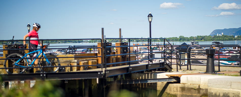
In the Montérégie region, it’s possible to see locks still in operation along the Chambly Canal Path. For 20 kilometers, boaters cruise towards Lake Champlain or the Chambly Basin. Photo credit: Tourisme Montérégie
Old railway turned cycling routes
Many of our bike paths were built on former railway. In the past, rail was the preferred method to get closer to rivers and lakes, among other things, for its ease of transporting materials. Today, there are a good number of trails with minimal grade changes.
A great example of this is in the Lower St. Lawrence region, in Témiscouata to be precise, far from the stress of major tourist centers and sites.
The Parc linéaire interprovinciale Petit Témis links Rivière-du-Loup in Quebec to Edmundston in New Brunswick, with a 134-kilometre stone-dust bike path. Several sections run from mature forests to marshes and along calm lakes.
But the highlight is the ride along Lake Témiscouata. For 28 kilometres, between Témiscouata-sur-le-Lac and Dégelis, the trail blends in with the lakeshore, offering ever-changing views of this expanse of water.
You’ll find picture-perfect views at one of the cantilevered wooden bridges along the lake.

The Petit Témis Interprovincial Linear Park passes through Témiscouata-sur-le-Lac, a small town overlooking the impressive Lake Témiscouata. Photo credit: Le Cycliste du dimanche
Along the Saint-Lawrence River
Quebec is also a river: the majestic St. Lawrence.
Two bike paths are quite popular for the vistas they present to two-wheeled adventurers.
On Montreal’s South Shore, along La Riveraine — the Ville de Lambert and Ville Longueuil sections of the Trans Canada Trail — cyclists can enjoy a breathtaking view of points of interest in the metropolis, on the other side of the river: the Biosphere, La Ronde, the Olympic Stadium and the Port of Montreal.
Farther east, in the Capitale-Nationale region, there’s plenty for cyclists who love world-class views.
On the banks of the St. Lawrence, the Parcours des Anses in Lévis is a multi-purpose, 15-kilometre corridor offering breathtaking views of the other side of the river. As you ride along, you can admire the old Quebec Bridge, the Fortifications of Québec National Historic Site, Château Frontenac, Île d’Orléans and Montmorency Falls.
It’s for these reasons that this bike path is often described as the most beautiful in Quebec.
For the past 30 years, Claude Plante has been exploring cycling paths in Quebec and elsewhere in Canada. His adventures have led him to become a columnist under the name “Cycliste du dimanche,” sharing his discoveries on social media. A career journalist, he worked at La Tribune de Sherbrooke for 30 years, and now works with the team at 107.7 Estrie (Cogeco Media), as well as writing for various organizations.
Follow him on Facebook @LeCyclisteduDimanche
Explore Quebec bike paths on our interactive map!
Feature photo: The P’tit Train du Nord offers a pleasant ride along Lac Raymond and the Rivière-du-Nord in the inspiring Laurentian region. Photo credit: Productions Adrénafilm


