Gemma’s Trans Canada Trail: Hiking and Cycling in Boundary Country, BC
Written by Gemma Taylor
My love for beyond-the-beaten-path travel and for the Trans Canada Trail perfectly combine in British Columbia’s Boundary Country. The Trans Canada Trail provides an almost uninterrupted 170-kilometre hiking and biking path across this quiet region of the province, roughly paralleling the Crowsnest Highway, or Highway 3.
The Trans Canada Trail route through Boundary Country follows the former Columbia & Western (C&W) and Kettle Valley railway lines, both constructed in the late 19th century to serve local mining interests and maintain Canadian sovereignty.
Boundary Country, if you’re not familiar, sits between the busy Okanagan Valley and the laid-back West Kootenays. I’ve explored many sections of the Trans Canada Trail in this underrated area of BC but, for me, a highlight has to be the Cascade Gorge section of the Columbia & Western Rail Trail, just south of Christina Lake.
Following the Kettle River
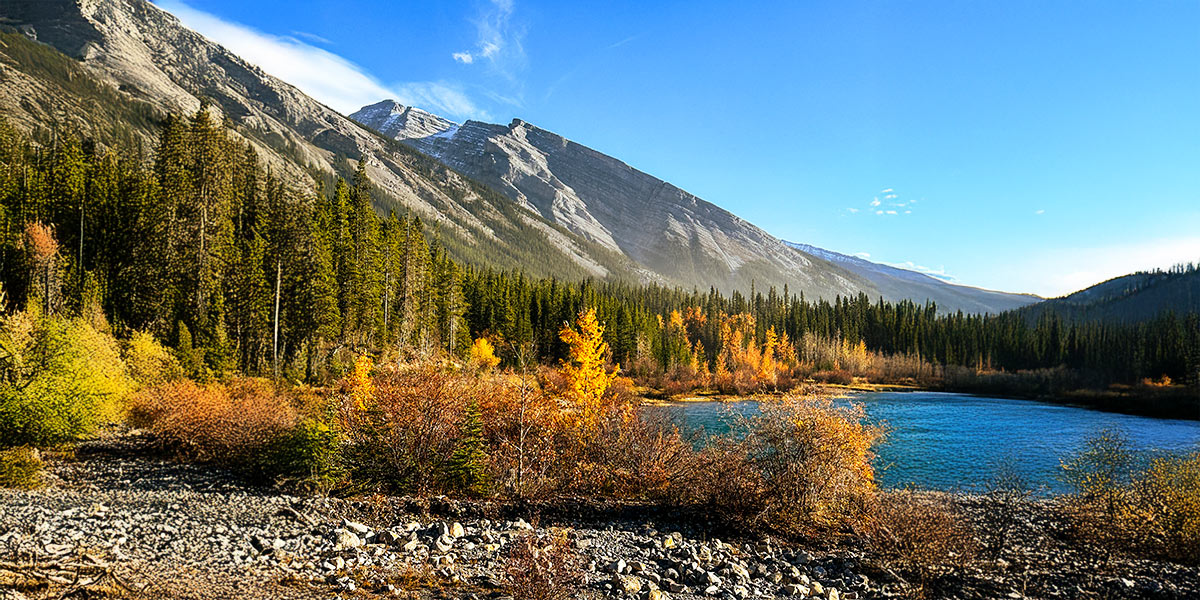
Here, the Kettle River rushes through a narrow canyon, creating a series of rapids, whirlpools and waterfalls. The river is so powerful that it has carved deep depressions, or “kettles,” into the surrounding rock walls (also the origin of the river’s name).
To explore it yourself, start in the Cascade Trestle parking lot, just off Highway 3. When driving from Grand Forks, the turn-off is located directly after the Welcome to Christina Lake sign on the right-hand side of the road, 200 meters before the junction with Highway 395.
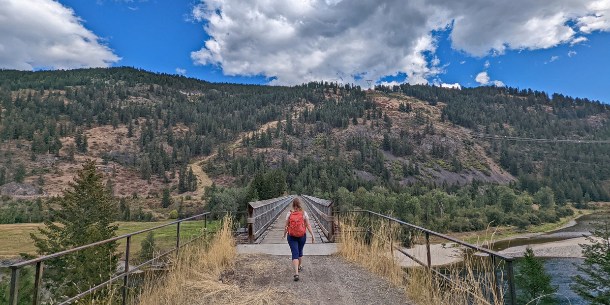
Walking or cycling east from the parking area, the trestle appears almost immediately (within only 100 meters!) This century-old Columbia & Western railway bridge sits high above the start of the gorge, offering the perfect vantage point to witness the lazy river transition into a wilder state.
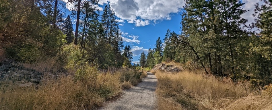
Photo credit: Off Track Travel
The view looked very different
Just over 100 years ago, this view looked very different. A huge dam sat across the gorge entrance, diverting the water through tunnels and piping to a nearby powerhouse.
The powerhouse in question was a particularly special one. Built in 1898 with state-of-the-art Tesla technology, it was the region’s first AC power-generating station. It can be hard to imagine this industrial history now, especially during sunny summer days when so many locals are cooling off in calmer parts of the river. A few established, but not maintained, trails lead from the picnic area down to the shoreline.
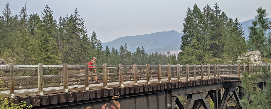
Photo credit: Off Track Travel
Visiting Cascade Falls
For a deeper look into the Cascade Gorge, continue across the trestle and along the flat Trans Canada Trail section. In the summer, it can be a little dusty here, so I would recommend shoes over sandals.
Look for a yellow sign marking a side route into the bordering ponderosa pine forest, 250 meters from the bridge (about a five-minute walk). The trail leads to the old concrete bulkhead of the power station, the only sign of the facility that powered many local communities until 1919.
After crossing the bulkhead, follow the path to the right to reach the cliff edge. Use extreme caution as there is no fence (keep children and animals very close). A winding trail leads along the top of the tall cliffs, offering multiple viewpoints of the rushing river in the canyon below. The most impressive sight is Cascade Falls, a 31-metre-high waterfall. During the spring runoff, the sound simply thunders.
Returning to the Trans Canada Trail, continue another kilometer east. The path crosses Highway 395 and then parallels the Christina Lake Golf Club. This 18-hole golf course sits on the former Cascade townsite, a community that quickly grew with the construction of the railway and generating station. At its peak in the 1890s, Cascade had a population of around 1,500 people.
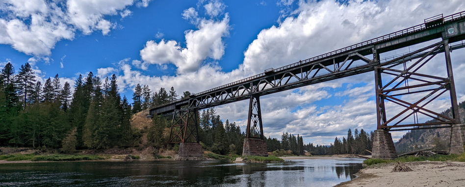
Photo credit: Off Track Travel
Crossing the Smitten Trestle
The finale of this Trans Canada Trail walk is the 153-metre-long Smitten Trestle, standing tall and proud over the Kettle River. The bridge, also constructed for the Columbia & Western Railway, boasts wonderful views of the river and surrounding mountains. A staircase leads down to the sandy edge of the river.
The return journey is via the same route. Be sure to allow at least 90 minutes for the 5-kilometre there-and-back walk from the Cascade Trestle to the Smitten Trestle via the Cascade Falls viewpoint.
If you don’t have the time or energy to walk all the way, each trestle can be visited separately. As mentioned, the Cascade Trestle is very close to a parking area. For the Smitten Trestle, park in the small lot on Highway 395. The round-trip walk to the Smitten Trestle takes around 30 minutes (2.2 kilometers).
Whichever you choose, both options provide a blend of natural beauty and local history, made accessible by the wonderfully wide and almost completely flat Trans Canada Trail.
Gemma Taylor is an outdoor adventure travel blogger based in Penticton, British Columbia. Happiest on the trail or with a canoe paddle in her hand, Gemma simply loves to be outside, the further off the beaten path the better! Visit Off Track Travel for detailed adventure guides and road trip itineraries.
Main photo credit: Off Track Travel


