Taryn’s Trans Canada Trail: Reexamining Familiar Landscapes on a Hike from Pemberton to Whistler
Written by Taryn Eyton
I peered through the SUV’s passenger window as scenery streaked past me along Highway 99: snow-capped mountains, train tracks, rushing rivers and huge powerlines blurred together. In a few places, I spied trails, disappearing into the forest, marked with small signs emblazoned with the logos of the Sea to Sky Trail and the Trans Canada Trail.
The Sea to Sky Trail runs for just over 100 kilometres from the oceanfront in Squamish, through the mountain town of Whistler to the farm country of the Pemberton Valley. It’s a spur on the much longer Trans Canada Trail. I live in Squamish and have hiked, biked or walked nearly all the Sea to Sky Trail — except the section between Pemberton and Whistler. That’s why a friend and I were driving to Pemberton on a sunny spring morning with a plan to hike the 26 kilometres back to Whistler.
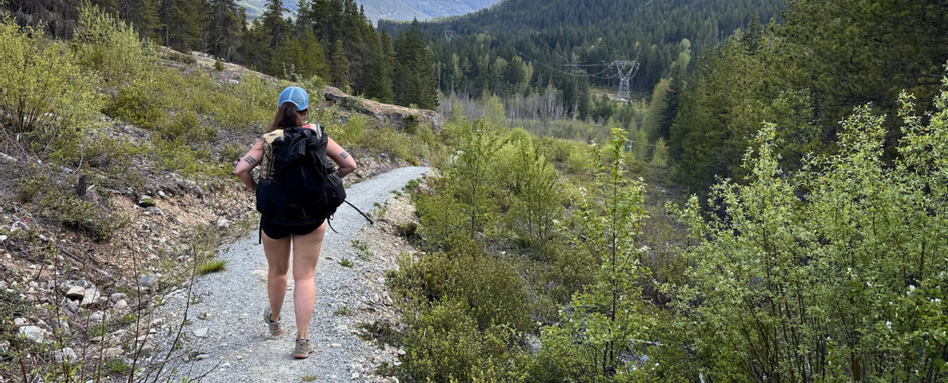
Photo credit: Taryn Eyton
One Mile Lake through Nairn Falls Provincial Park
We started our hike at One Mile Lake, walking the path along the familiar shoreline I had seen countless times from the car. As the trail dipped into the forest the highway noise vanished, replaced by robins singing in the canopy. We were delighted to find clusters of bright yellow arnica dotting a hillside as we rounded a switchback. After hiking through the campground at Nairn Falls Provincial Park, we paused to admire the view of the Green River from a bluff. Its rushing glacial waters carved this valley over millennia, and the trail would take us back to its banks several times on our hike.
Leaving the park, we quickly crossed Highway 99. The Sea to Sky Trail markers pointed us under the powerlines and past flowering dogwood trees to a newly built section of trail. While the climb up onto a bluff was tiring, the view of Mount Currie across the valley was worth it. We would be walking in the shadow of this imposing 2,591-metre peak all day. It is known as Tszil to the Lil’wat Nation, which means “slides on the mountain,” and we could see evidence of spring avalanches on its upper slopes.
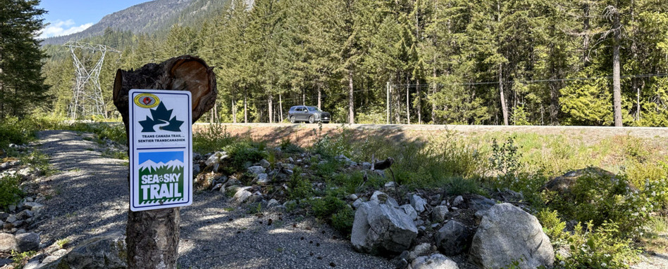
Photo credit: Taryn Eyton
The tracks told stories of who had been there before
As we continued to hike, tracks in the dusty footbed told the story of who had been there before us: a few cyclists, a lone hiker with a dog, countless deer and a bobcat, evidenced by the tracks of its splayed toes. While the trail was designed for people, it had become a wildlife corridor too.
In a quiet grove of cedars between a granite cliff and the railway tracks, we found the nearly collapsed remains of an old cabin. While the valley is busy today, just 50 years ago, the road in this area was unpaved, traffic was light, and people still lived in the bush making a living as trappers or loggers.
While the dream for the Sea to Sky Trail is to build an uninterrupted trail, some off-road gaps remain, so parts run on the shoulder of Highway 99. We made quick work of a short section of highway, crossing bridges over the turbulent waters of Rutherford Creek and the Soo River, both tributaries of the Green River. Leaving the highway, we walked the gravel road past a community-run motocross track and stockcar speedway. The area was quiet on a weekday morning, but I could imagine it buzzing with activity on a summer weekend.
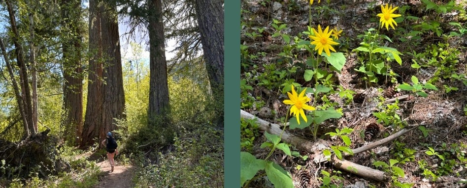
Photo credit: Taryn Eyton
Through Gord’s Garden to Whistler
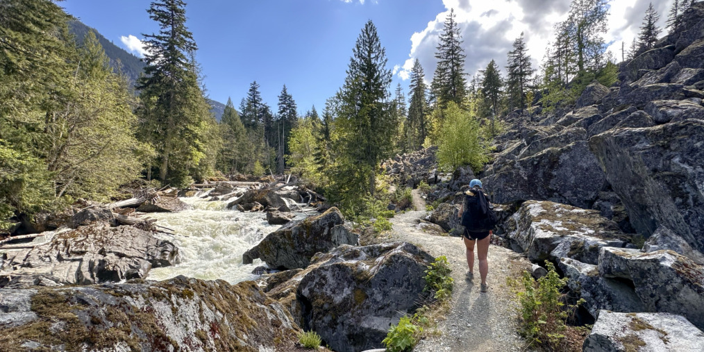
My favourite stretch came next: Gord’s Garden. The path winds along the banks of the Green River past sandy beaches, groves of old-growth Douglas fir and a boulder field created by a prehistoric landslide. This is the wildest part of the trail since it is the farthest from Highway 99. It’s named for Whistler local Gord McKeever, who was the first champion of the Sea to Sky Trail.
Nearing Whistler, the trail twisted away from the river and undulated between the forest and a powerline cut. We found more signs of wildlife, including fresh piles of bear scat, speckled with pieces of undigested grass and shoots, a staple of their spring diet. After eight hours on the trail, we finished our hike in Wedgewoods, Whistler’s northernmost neighbourhood, where we met the Green River for a final time.
Slow down and walk through it
I’ve driven this route countless times, but walking through it deepened my connection to the land. Now, when I drive past, I can imagine the bobcats, deer and bears sharing the trail with hikers and bikers, just out of view of the motorists. I’ll return to spots where wildflowers and dogwoods bloom each spring and take my bike back to experience the thrill of riding through an ancient boulder garden. This hike reinforced a lesson I keep learning: the best way to truly know a place is to slow down and walk through it.
Taryn Eyton is a Squamish-based writer and the founder of the outdoor adventure website, HappiestOutdoors.ca. She is also the author of two hiking guidebooks: Backpacking in Southwestern British Columbia: The Essential Guide to Overnight Hiking Trails (Greystone Books, 2021) and Backpacking on Vancouver Island: The Essential Guide to the Best Multi-Day Trips and Day Hikes (Greystone Books, 2024). Taryn is a Leave No Trace Master Educator, the President of the Friends of Garibaldi Park Society, a member of the Board of Directors of the Vancouver International Mountain Film Festival, and a Fellow of the Canadian Geographic Society.
Follow her on Instagram at @happiestoutdoors or Facebook at https://www.facebook.com/happiestoutdoors.
Explore the Sea to Sky Trail from Squamish to Pemberton on our interactive map and find more suggestions for outdoor activities in Whistler here!
Main photo credit: Taryn Eyton


