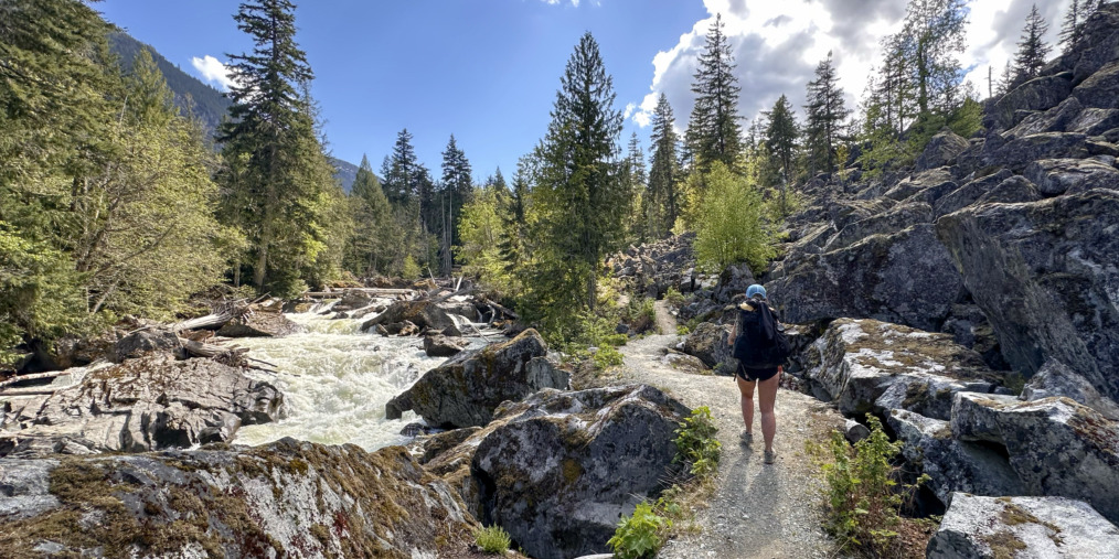
Taryn’s Trans Canada Trail: 5 Places to Hike the Trail Near Whistler
Written by Taryn Eyton
The Sea to Sky Trail spans from Squamish to Whistler to Pemberton, connecting to several community trails along the way. As a local, I was surprised to discover that the Sea to Sky Trail is part of the Trans Canada Trail. It’s exciting to think I could set out from Whistler and continue across the country! If you’re looking for a short hike in Whistler, it’s easy to experience a bit of the Trail on one of the five trail sections highlighted below.
Tips for Hiking the Trans Canada Trail Near Whistler
• The Trail is in the valley, so is usually snow-free between April and November. In the winter, the Trail is still accessible but snowshoes or microspikes are a good idea.
• The Whistler Valley is prime bear habitat. Hike in a group, make noise and carry bear spray just in case. Bears usually avoid hikers, but you don’t want to surprise them.
• The Trans Canada Trail in Whistler is a multi-use trail open to hikers and cyclists. Expect to share the Trail. If you plan to cycle, a gravel bike or mountain bike is the best choice.
Brandywine Falls and the Bungee Bridge
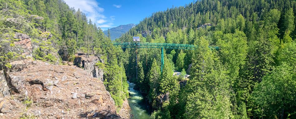
The spectacular 70-metre-tall Brandywine Falls plunges over volcanic rocks into a deep canyon a few minutes south of Whistler. The 0.6-kilometre trail to the viewing platform is flat and easy, so that’s as far as most visitors go. But I recommend heading east along the Trans Canada Trail for 2 kilometres for more views. You’ll pass a viewpoint of Daisy Lake and then hike through an old lava field before arriving at the edge of the Cheakamus River Canyon. Peer down to the churning waters from a viewpoint on the rim of the canyon or from the deck of the nearby Bungee Bridge. If you’re lucky, you’ll see thrill-seekers bungee jumping.
Whistler Train Wreck and the Cheakamus River
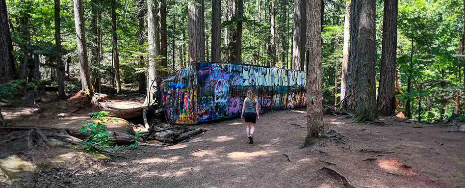
The route to the abandoned rail cars at Whistler Train Wreck is a hike I keep repeating since it has a great effort-to-reward ratio. It starts on the Trans Canada Trail and works its way gently downhill through the temperate rainforest. Detour west onto the Train Wreck Express Trail to hike over a suspension bridge to reach the graffiti-covered train cars about one kilometre from the start. If you’re looking for a longer adventure, follow the Trail south through the forest. A bridge over the Cheakamus River 3 kilometres later makes a good turn-around point.
Lost Lake and Beaches
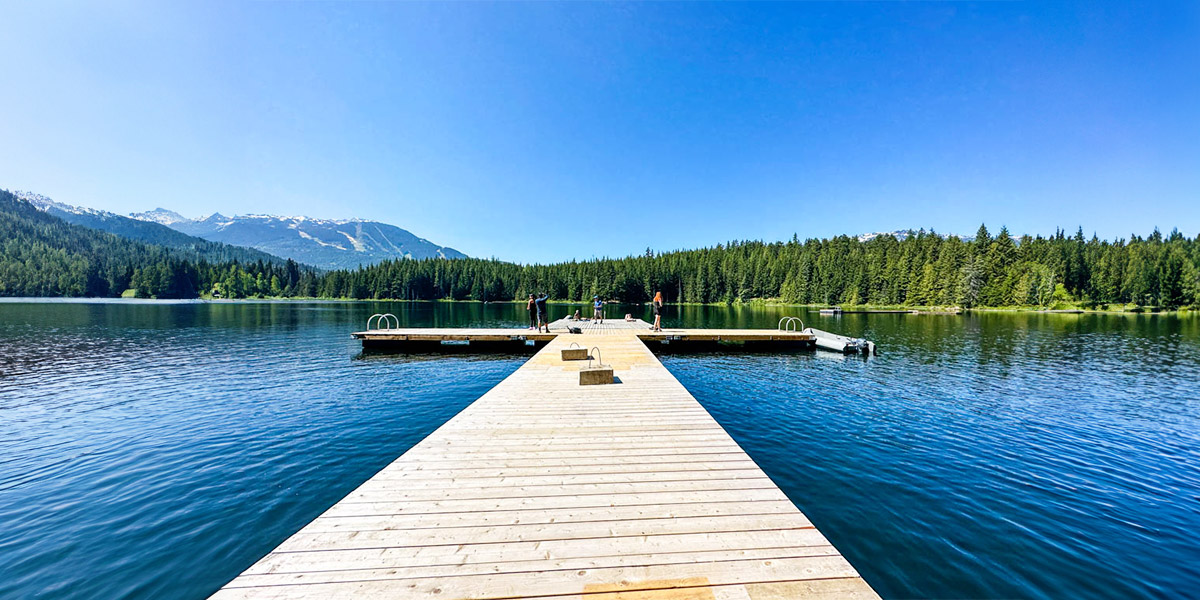
Located just a few minutes’ walk from Whistler Village, Lost Lake has a great network of hiking and mountain biking trails. One of my favourite routes starts from the Passivhaus entrance near the Whistler Day Lots. From there, I follow the 4.5-kilometre-long Lost Lake Loop, which is part of the Trans Canada Trail. The trail circles the lake past the main beach at the south end and the big dock on the east side. Both are great spots for swimming, so don’t forget your bathing suit!
Parkhurst Ghost Town and Green Lake
One of the most interesting places to explore near Whistler is the abandoned logging town of Parkhurst on the northeast side of Green Lake. While you can paddle across the lake, you can also walk or bike along the lake using the Trail from its north and south ends. In the north, pick up the trail on Riverside Drive and follow it for 2.3 kilometres through the forest to the junction with the Parkhurst Trail. A longer, but more scenic option, is to start in the south at Lost Lake and follow the Trail high above the shore of Green Lake. It’s 5 kilometres from Lost Lake to the Parkhurst junction. The ghost town is an easy 0.4-kilometre walk from the junction and includes lots of falling-down buildings and abandoned cars and machinery.
One Mile Lake and Nairn Falls
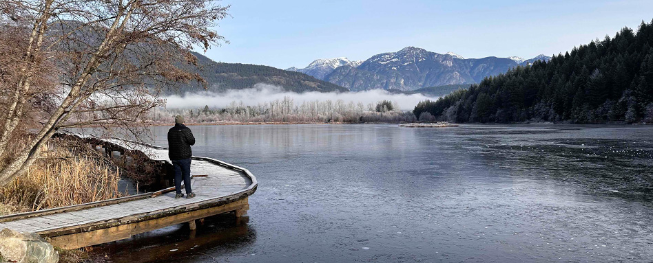
You’ll find tiny One Mile Lake about one mile (1.6 kilometres) from downtown Pemberton a few minutes north of Whistler. The short and flat trail around the lake is only 1.5 kilometres long, but you can take the path on the east side of the lake (part of the Trans Canada Trail) into town, where you can grab a hot drink at Mount Currie Coffee. If you’re looking for a longer hike, I recommend following the Trail south to Nairn Falls Provincial Park. Along the way, you’ll walk through a challenging disc golf course set into the forest. It’s another kilometre from the park campground on a hike-only trail to the Nairn Falls viewpoint in a granite canyon.
Taryn Eyton is a Squamish-based writer and the founder of the outdoor adventure website, HappiestOutdoors.ca. She is also the author of two hiking guidebooks: Backpacking in Southwestern British Columbia: The Essential Guide to Overnight Hiking Trails (Greystone Books, 2021) and Backpacking on Vancouver Island: The Essential Guide to the Best Multi-Day Trips and Day Hikes (Greystone Books, 2024). Taryn is a Leave No Trace Master Educator, the President of the Friends of Garibaldi Park Society, a member of the Board of Directors of the Vancouver International Mountain Film Festival, and a Fellow of the Canadian Geographic Society. Follow her on Instagram at @happiestoutdoors or Facebook at https://www.facebook.com/happiestoutdoors


