Trans Canada Trail’s Accessibility Mapping Program, in partnership with AccessNow, expands to all 13 provinces and territories
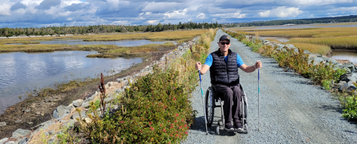
An additional 25 Trail sections are now available in the AccessNow app, enabling people to make informed decisions about safe, accessible experiences on the Trans Canada Trail
Montreal, February 14, 2022 – Trans Canada Trail and AccessNow are excited to announce that they have expanded their successful Accessibility Mapping Program to all 13 provinces and territories. Launched in 2021, the program uses AccessNow technology to document the lived experience of trail users with disabilities.
The accessibility information collected is made available on the AccessNow app, so trail users of all abilities can make informed decisions before heading out on the Trans Canada Trail. It also provides the data needed to identify those areas where barriers need to be removed, resulting in improved accessibility. An additional 25 Trail sections are now available in the AccessNow app on the Apple app store and Google Play, bringing the total number of accessibility-mapped Trans Canada Trail sections on the app to 37.
“Trans Canada Trail is proud to build on its partnership with AccessNow to enhance accessibility along sections of the Trail. We want people of all abilities to enjoy safe, outdoor experiences with their friends, families and neighbours,” says Eleanor McMahon, President & CEO of Trans Canada Trail. “With trail use up 50% since the onset of COVID-19, it’s clear that people in Canada value access to natural spaces to stay active, take care of their mental and physical health, and socially connect with others.”
“Trans Canada Trail is committed to creating a national and cohesive approach to trail accessibility mapping by leading the trail sector in adopting a lived-experience approach to making the Trail a safe, accessible place,” adds McMahon. “It’s exciting to see momentum build with every round of mapping completed. Making sure our trail project decisions are informed by the perspectives of people with a broad range of disabilities is incredibly important,” she adds.
Each mapper is paired with a local trail guide, and using data collection, photography and descriptions, the mapper captures their experience on the Trail. Trans Canada Trail then works closely with local trail operators to implement recommendations from the mappers to improve accessibility.
“At AccessNow we are focused on connecting people to diverse accessible experiences across Canada and beyond. Now, more than ever, access to the outdoors plays such an important role in supporting mental and physical well-being and we are incredibly proud of our partnership with Trans Canada Trail. In amplifying the lived experiences of people with disabilities, we are showcasing authentic leadership and commitment to building an inclusive and diverse program. Together we actively work to remove barriers for visitors to discover enriching, safe and beautiful nature spaces for all,” says Maayan Ziv, Founder & CEO of AccessNow.
These sections of the Trail are now accessibility-mapped and are available on the AccessNow app:
- Town of Hay River, NT (mapped by Bryson Asels)
- Galloping Goose, Capital Region District, BC (Marnie Essery)
- City of Dawson Creek, BC (Valerie Slonak)
- Morning Mountain, Nelson, BC (Kimberly Joines)
- Rocky Mountain Legacy Trail, Banff, AB (Anya Morgan)
- City of Calgary, Calgary, AB (Aaron Prevost and Alex Wist)
- Fish Creek Provincial Park, Calgary, AB (Aaron Prevost and Alex Wist)
- Edmonton River Valley, Edmonton, AB (Nicole Palladino)
- Strathcona County, Strathcona, AB (Nicole Palladino)
- Danielson Provincial Park, Danielson Provincial Park, SK (Lisa Franks)
- Douglas Provincial Park, Douglas Provincial Park, SK (Lisa Franks)
- Meewasin, Saskatoon, SK (Lisa Franks)
- Falcon South Shore Trail, West Hawk Lake, MB (George Loewen)
- Kawartha Trans Canada Trail, Lindsay/Peterborough, ON (Jericho Go and Jake Lawless)
- Kate Pace Way, North Bay, ON (Rick Watters)
- Ottawa to Carlton Place, Ottawa, ON (Camille Bérubé)
- Gros Cap Water access point, Sault Ste. Marie, ON (Diane Morrell)
- Corridor du Littoral, Quebec City, QC (Abi Tripp)
- Newfoundland T’railway, Conception Bay/Saint John’s, NL (Kim White)
- City of Fredericton-Valley and South Riverfront Trails, Fredericton, NB (Randy Dickinson)
- City of Fredericton-North Side Trail, Fredericton, NB (Randy Dickinson)
- Lincoln Trail, Fredericton, NB (Randy Dickinson)
- Lake Verde, Charlottetown, PE (Alan Stanley)
- Atlantic View Trail, Lawrencetown, NS (Paul Tingley)
- Salt Marsh Trail, Lawrencetown, NS (Paul Tingley)
In 2021, the first year of the program, 12 sections of the Trans Canada Trail were mapped and made available on the AccessNow app. As well, several projects were undertaken by local trail operators to improve accessibility, based on recommendations from the mappers.
Another round of mapping starts in spring 2022, with many more Trail sections scheduled to be completed by fall 2022.
Resources:
- Learn more about AccessNow: AccessNow.com
- Find the AccessNow app on the Apple app store or Google Play
- Download a graphic map of the Trans Canada Trail.
- Find your local section of the Trail here.
- Read Trans Canada Trail’s Léger survey research on trail use in Canada: June 2020; November 2020; August 2021.
- Read our Conference Board of Canada report on the health, environmental and economic benefits of Canada’s trail system.
About Trans Canada Trail
The Trans Canada Trail is the world’s longest network of multi-use recreational trails. The Trail stretches more than 28,000 km – and continues to grow – across every province and territory. It’s a showcase of Canada’s diverse landscapes and cultures, and a sustainable national asset that fosters unity, collaboration and connectedness. Our national trail is managed by local trail groups and partners who work in conjunction with Trans Canada Trail, a registered charity. tctrail.ca


